 NERC Data Catalogue Service
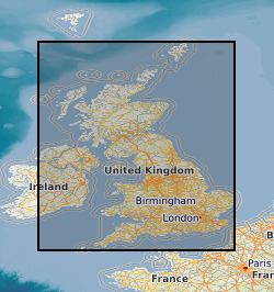
National Bedrock Fence Diagram of Great Britain (GB3D_v2012)
In 2011 the British Geological Survey (BGS) decided to begin the assembly of a National Geological Model (NGM) from its existing and on-going geological framework models , comprising integrated national crustal, bedrock and Quaternary models. The bedrock component is the most advanced of these themes and comprises both the calculated models and a complementary network of cross-sections that provide a fence diagram for the bedrock geology of Great Britain. This fence diagram, the GB3D_v2012 dataset is available in a variety of formats from the BGS website www.bgs.ac.uk as free downloads. It complements the existing 1:625 000 scale mapsheets published by BGS utilising the same colour schema and geological classification. The 121 component cross-sections extend to depths between 1.5 and 6 km; they have an aggregate length of over 20,000 km, and they are snapped together at their intersections to ensure total consistency. The sections are based on the existing BGS geological framework models where they cut through them, they also take account of the vast wealth of published data on the subsurface structure of Britain both from BGS and in the literature. Much of this is in the form of cross-sections, contour maps of surfaces, and thicknesses (isopachs). The fence diagram has been built in the Geological Surveying and Investigation in 3D (GSI3D) software. It is envisaged that this dataset will form a useful educational resource for geoscience students and the general public, and also provide the bedrock geology context and structure for regional and catchment scale studies. The fence diagram was built in 2009-12 using funding from the BGS National Capability Programme and the Environment Agency of England and Wales. 14 expert regional geologists compiled the sections.
Simple
- Date (Publication)
- 2012
Distributor
British Geological Survey
-
Enquiries
0115 936 3276
Environmental Science Centre, Nicker Hill, Keyworth
,
NOTTINGHAM
,
NOTTINGHAMSHIRE
,
NG12 5GG
,
United Kingdom
0115 936 3143
0115 936 3276
Point of contact
British Geological Survey
-
Enquiries
0115 936 3276
Environmental Science Centre, Nicker Hill, Keyworth
,
NOTTINGHAM
,
NOTTINGHAMSHIRE
,
NG12 5GG
,
United Kingdom
0115 936 3143
0115 936 3276
Custodian
British Geological Survey
-
Enquiries
0115 936 3276
Environmental Science Centre, Nicker Hill, Keyworth
,
NOTTINGHAM
,
NOTTINGHAMSHIRE
,
NG12 5GG
,
United Kingdom
0115 936 3143
0115 936 3276
- Maintenance and update frequency
- annually Annually
- GEMET - INSPIRE themes, version 1.0
- BGS Thesaurus of Geosciences
-
- Fence diagrams
- Geology
- dataCentre
- Keywords
-
- NERC_DDC
- Access constraints
- otherRestrictions Other restrictions
- Use constraints
- otherRestrictions Other restrictions
- Other constraints
- The copyright of materials derived from the British Geological Survey's work is vested in the Natural Environment Research Council [NERC]. No part of this work may be reproduced or transmitted in any form or by any means, or stored in a retrieval system of any nature, without the prior permission of the copyright holder, via the BGS Intellectual Property Rights Manager. Use by customers of information provided by the BGS, is at the customer's own risk. In view of the disparate sources of information at BGS's disposal, including such material donated to BGS, that BGS accepts in good faith as being accurate, the Natural Environment Research Council (NERC) gives no warranty, expressed or implied, as to the quality or accuracy of the information supplied, or to the information's suitability for any use. NERC/BGS accepts no liability whatever in respect of loss, damage, injury or other occurence however caused.
- Other constraints
- Either: (i) the dataset is made freely available, e.g. via the Internet, for a restricted category of use (e.g. educational use only); or (ii) the dataset has not been formally approved by BGS for access and use by external clients under licence, but its use may be permitted under alternative formal arrangements; or (iii) the dataset contains 3rd party data or information obtained by BGS under terms and conditions that must be consulted in order to determine the permitted usage of the dataset. Refer to the BGS staff member responsible for the creation of the dataset if further advice is required. He / she should be familiar with the composition of the dataset, particularly with regard to 3rd party IPR contained in it, and any resultant use restrictions. This staff member should revert to the IPR Section (ipr@bgs.ac.uk ) for advice, should the position not be clear.
- Denominator
- 10000
- Metadata language
- EnglishEnglish
- Topic category
-
- Geoscientific information
- Geographic identifier
-
GBN
- Date (Revision)
- 2009
- Geographic identifier
-
GREAT BRITAIN [id=139600]
- Date (Creation)
- 1979
N
S
E
W
))
- Begin date
- 2009
- End date
- 2012 Before
- Supplemental Information
- The fence diagram has been frozen at the end of 2012, it is anticipated that it will be enhanced further in terms of detail and depth in future years. Probably updated annually and released as new versions. We recommend that this dataset should be used for General and geosciences education to illustrate of national and regional British bedrock geology (from the available download), Illustrating national or regional bedrock geology overviews for scientific publications for widespread and/or non specialist use and Regional GIS projects including the extents (x,y) of individual geological units (generated for GIS in GSI3D). We recommend that this dataset should not be used for Detailed geological assessments of any kind, e.g. borehole, site or linear route prognosis, resource-reserve estimation and exploration of any kind and any representation or use outside the intended regional to national (250K-1M) resolution.
- Unique resource identifier
- OSGB 1936 / British National Grid (EPSG::27700)
- Distribution format
-
-
3D PDF
(
witheld
)
-
KMZ
(
witheld
)
-
*.gsipre file for use in the BGS LithoFrame Viewer
(
witheld
)
-
3D PDF
(
witheld
)
Distributor
British Geological Survey
-
Enquiries
0115 936 3276
Environmental Science Centre, Nicker Hill, Keyworth
,
NOTTINGHAM
,
NOTTINGHAMSHIRE
,
NG12 5GG
,
United Kingdom
0115 936 3143
0115 936 3276
- OnLine resource
-
Citation Information - Digital Object Identifier (DOI)
(
WWW:LINK-1.0-http--related
)
British Geological Survey. (2012). National Bedrock Fence Diagram of Great Britain - GB3D_v2012. NERC British Geological Survey. https://doi.org/10.5285/F60C6923-0BD2-4469-BC7A-9C0775453AC8
- Hierarchy level
- dataset Dataset
- Other
- dataset
Conformance result
- Date (Publication)
- 2011
- Explanation
- See the referenced specification
- Pass
- No
Conformance result
- Date (Publication)
- 2010-12-08
- Explanation
- See http://eur-lex.europa.eu/LexUriServ/LexUriServ.do?uri=OJ:L:2010:323:0011:0102:EN:PDF
- Pass
- No
- Statement
- The initial fence diagram build in 2009-10 was funded by the Environment Agency of England and Wales (EA). This phase of the development comprised 41 cross-sections with a total linear length of 5,500 km confined to England and Wales. In 2011 this initial network was extended to Scotland, and the earlier coverage was densified. Additional sections were also aligned along the coast to bound the coverage and provide the easily recognisable outline of Great Britain paving the way for offshore expansion of the model. Sections in northern Scotland were continued across the Minch to the Outer Hebrides and similarly to Orkney but at present Shetland has not been incorporated. In 2012, with further funding from the EA, a few additional sections were inserted into the framework for England and Wales, whilst others were extended in length or deepened in key sedimentary basins. This enhancement comprised part of a study to provide a risk screening tool for the EA to help them gauge possible impacts of shale gas extraction on aquifer security.
- File identifier
- d13301c5-867d-5245-e044-0003ba9b0d98 XML
- Metadata language
- EnglishEnglish
- Hierarchy level
- dataset Dataset
- Date stamp
- 2026-05-03
- Metadata standard name
- UK GEMINI
- Metadata standard version
- 2.3
Point of contact
British Geological Survey
Environmental Science Centre, Keyworth
,
NOTTINGHAM
,
NOTTINGHAMSHIRE
,
NG12 5GG
,
United Kingdom
+44 115 936 3100
- Dataset URI
- http://data.bgs.ac.uk/id/dataHolding/13605695
Overviews
Spatial extent
N
S
E
W
Provided by

Associated resources
Not available