 NERC Data Catalogue Service
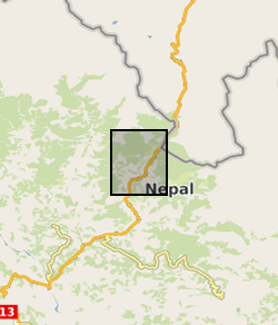
Polygon inventory of 481 landslides mapped along the Arniko Highway, Nepal (NERC Grant NE/L002582/1)
Polygon shapefile including 481 coseismic and climate triggered landslides mapped along the Arniko Highway, Nepal, using a combination of field mapping and remote sensing. All mapped landslides were those visible in the landscape during the period 2017 – 2018. Landslides were mapped using a combination of field and remote sensing methodologies (see lineage). The inventory includes the landslide locations, perimeters (Length field), areas, types (for field mapped landslides), and whether a given landslide was mapped in the field or remotely (source field). These landslides were mapped for a range of purposes, from conducting landslide susceptibility assessments, to investigating landslide processes and preconditioning.
Simple
- Date (Creation)
- 2021-06-21
Originator
University of Plymouth
-
Joshua Jones
(
School of Geography, Earth and Environmental Sciences
)
Plymouth
,
- Maintenance and update frequency
- notApplicable notApplicable
- GEMET - INSPIRE themes, version 1.0
- BGS Thesaurus of Geosciences
-
- Landslides
- NGDC Deposited Data
- dataCentre
- Keywords
-
- NERC_DDC
- Access constraints
- otherRestrictions Other restrictions
- Other constraints
- licenceOGL
- Use constraints
- otherRestrictions Other restrictions
- Other constraints
- The copyright of materials derived from the British Geological Survey's work is vested in the Natural Environment Research Council [NERC]. No part of this work may be reproduced or transmitted in any form or by any means, or stored in a retrieval system of any nature, without the prior permission of the copyright holder, via the BGS Intellectual Property Rights Manager. Use by customers of information provided by the BGS, is at the customer's own risk. In view of the disparate sources of information at BGS's disposal, including such material donated to BGS, that BGS accepts in good faith as being accurate, the Natural Environment Research Council (NERC) gives no warranty, expressed or implied, as to the quality or accuracy of the information supplied, or to the information's suitability for any use. NERC/BGS accepts no liability whatever in respect of loss, damage, injury or other occurence however caused.
- Other constraints
- Available under the Open Government Licence subject to the following acknowledgement accompanying the reproduced NERC materials "Contains NERC materials ©NERC [year]"
- Spatial representation type
- vector Vector
- Metadata language
- EnglishEnglish
- Topic category
-
- Geoscientific information
- Geographic identifier
-
NEPAL [id=497000]
- Date (Creation)
- 1979
- Geographic identifier
-
NP
- Date (Revision)
- 2009
- Geographic identifier
-
NPL
- Date (Revision)
- 2009
N
S
E
W
))
- Begin date
- 2018-10-01
- End date
- 2020-10-01
- Unique resource identifier
- WGS 84 / UTM zone 45N (EPSG::32645)
- Distribution format
-
-
ESRI Shapefile
()
-
ESRI Shapefile
()
- OnLine resource
- Data ( WWW:DOWNLOAD-1.0-http--download )
- Hierarchy level
- dataset Dataset
- Other
- dataset
Conformance result
- Date (Publication)
- 2011
- Explanation
- See the referenced specification
- Pass
- No
Conformance result
- Date (Publication)
- 2010-12-08
- Explanation
- See http://eur-lex.europa.eu/LexUriServ/LexUriServ.do?uri=OJ:L:2010:323:0011:0102:EN:PDF
- Pass
- No
- Statement
- Landslides were mapped using a combination of field mapping and remote sensing. Field mapped landslides were identified during walk-over surveys conducted in October 2019. The locations and geometries of these landslides were recorded using a hand-held Garmin GPS unit and a TruPulse laser range finder. The exact geometries of these field-observed landslides were then corroborated using high resolution CNES/Airbus imagery from 2017 obtained from GoogleEarthPro. Furthermore, as not all landslides were accessible in the field, additional landslides in the landscape were mapped from the CNES/Airbus imagery alone, where all visible landslides in the imagery were delineated as polygons that included the source, runout and deposition zones of each landslide. For the field-mapped landslides, the landslide type was classified according to the terminology of Varnes (1958).
- File identifier
- c61194fd-4149-5552-e054-002128a47908 XML
- Metadata language
- EnglishEnglish
- Hierarchy level
- dataset Dataset
- Date stamp
- 2025-12-11
- Metadata standard name
- UK GEMINI
- Metadata standard version
- 2.3
Point of contact
British Geological Survey
Environmental Science Centre,Keyworth
,
NOTTINGHAM
,
NOTTINGHAMSHIRE
,
NG12 5GG
,
United Kingdom
+44 115 936 3100
- Dataset URI
- http://data.bgs.ac.uk/id/dataHolding/13607780
Overviews
Spatial extent
N
S
E
W
Provided by

Associated resources
Not available