 NERC Data Catalogue Service
Attribute point inventory of 12,838 Asia Summer Monsoon (ASM) Triggered landslides in Nepal (NERC Grant NE/L002582/1)
This is a point (.txt) file of 12,838 Asia Summer Monsoon (ASM) - triggered landslides that occurred across central-eastern Nepal in the period 1988 - 2018. This inventory includes the landslide locations (x, y coordinates of landslide crests) and geometries, as well as the following landslide attributes, where each attribute was extracted at the position of the landslide crest: elevation (m), slope (o), aspect (o), planform and profile curvature, excess topography (m3), local relief (m), distance to channel (m), distance to road (m), near channel ksn, near channel specific stream power (SSP), average 30-year precipitation, total annual rainfall, peak monthly rainfall, landuse, Permafrost index, geology, and tectonic unit. Note, landslides were not mapped in the years 2011 and 2012 due to scan line errors in the Landsat 7 imagery. These landslides and associated attributes were collected for the purpose of assessing how landslide spatial distributions and susceptibility vary through time.
Simple
- Date (Creation)
- 2021-06-21
Originator
University of Plymouth
-
Joshua Jones
(
School of Geography, Earth and Environmental Sciences
)
Plymouth
,
- Maintenance and update frequency
- notApplicable notApplicable
- GEMET - INSPIRE themes, version 1.0
- BGS Thesaurus of Geosciences
-
- Landslides
- Monsoon
- NGDC Deposited Data
- dataCentre
- Keywords
-
- NERC_DDC
- Access constraints
- otherRestrictions Other restrictions
- Other constraints
- licenceOGL
- Use constraints
- otherRestrictions Other restrictions
- Other constraints
- The copyright of materials derived from the British Geological Survey's work is vested in the Natural Environment Research Council [NERC]. No part of this work may be reproduced or transmitted in any form or by any means, or stored in a retrieval system of any nature, without the prior permission of the copyright holder, via the BGS Intellectual Property Rights Manager. Use by customers of information provided by the BGS, is at the customer's own risk. In view of the disparate sources of information at BGS's disposal, including such material donated to BGS, that BGS accepts in good faith as being accurate, the Natural Environment Research Council (NERC) gives no warranty, expressed or implied, as to the quality or accuracy of the information supplied, or to the information's suitability for any use. NERC/BGS accepts no liability whatever in respect of loss, damage, injury or other occurence however caused.
- Other constraints
- Available under the Open Government Licence subject to the following acknowledgement accompanying the reproduced NERC materials "Contains NERC materials ©NERC [year]"
- Spatial representation type
- textTable Text, table
- Metadata language
- EnglishEnglish
- Topic category
-
- Geoscientific information
- Geographic identifier
-
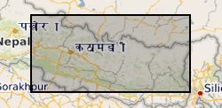
NEPAL [id=497000]
- Date (Creation)
- 1979
- Geographic identifier
-
NP
- Date (Revision)
- 2009
- Geographic identifier
-
NPL
- Date (Revision)
- 2009
N
S
E
W
))
- Begin date
- 2018-10-01
- End date
- 2020-10-01
- Unique resource identifier
- WGS 84 / UTM zone 45N (EPSG::32645)
- Distribution format
-
-
Text file (TXT)
()
-
Text file (TXT)
()
- OnLine resource
- Data ( WWW:DOWNLOAD-1.0-http--download )
- Hierarchy level
- dataset Dataset
- Other
- dataset
Conformance result
- Date (Publication)
- 2011
- Explanation
- See the referenced specification
- Pass
- No
Conformance result
- Date (Publication)
- 2010-12-08
- Explanation
- See http://eur-lex.europa.eu/LexUriServ/LexUriServ.do?uri=OJ:L:2010:323:0011:0102:EN:PDF
- Pass
- No
- Statement
- Landslides were initially mapped manually as polygons through visual interpretation of pre- and post monsoon season Landsat images (pre- and post-sat columns of the inventory). All landslide polygons included the source, runout, and deposition zones, as these were not distinguishable at the resolution of the imagery. The highest point, geometries and attributes of each landslide were then extracted using standard GIS tools.
- File identifier
- c60f9479-58c0-3531-e054-002128a47908 XML
- Metadata language
- EnglishEnglish
- Hierarchy level
- dataset Dataset
- Date stamp
- 2025-12-11
- Metadata standard name
- UK GEMINI
- Metadata standard version
- 2.3
Point of contact
British Geological Survey
Environmental Science Centre,Keyworth
,
NOTTINGHAM
,
NOTTINGHAMSHIRE
,
NG12 5GG
,
United Kingdom
+44 115 936 3100
- Dataset URI
- http://data.bgs.ac.uk/id/dataHolding/13607777
Overviews
Spatial extent
N
S
E
W
Provided by

Associated resources
Not available