
Marine Maps and Charts Archive (1960 onwards)
Simple
- Date (Creation)
- 1960
0115 936 3276
0115 936 3276
- Maintenance and update frequency
- asNeeded As needed
- GEMET - INSPIRE themes, version 1.0
- BGS Thesaurus of Geosciences
-
- Marine geology
- Maps
- Marine geophysics
- Site investigations
- Marine surveys
- dataCentre
- Keywords
-
- NERC_DDC
- Access constraints
- otherRestrictions Other restrictions
- Other constraints
- Varies by map, some maps will be open. Other maps may be restricted.
- Use constraints
- otherRestrictions Other restrictions
- Other constraints
- The copyright of materials derived from the British Geological Survey's work is vested in the Natural Environment Research Council [NERC]. No part of this work may be reproduced or transmitted in any form or by any means, or stored in a retrieval system of any nature, without the prior permission of the copyright holder, via the BGS Intellectual Property Rights Manager. Use by customers of information provided by the BGS, is at the customer's own risk. In view of the disparate sources of information at BGS's disposal, including such material donated to BGS, that BGS accepts in good faith as being accurate, the Natural Environment Research Council (NERC) gives no warranty, expressed or implied, as to the quality or accuracy of the information supplied, or to the information's suitability for any use. NERC/BGS accepts no liability whatever in respect of loss, damage, injury or other occurence however caused.
- Other constraints
- Either: (i) the dataset is made freely available, e.g. via the Internet, for a restricted category of use (e.g. educational use only); or (ii) the dataset has not been formally approved by BGS for access and use by external clients under licence, but its use may be permitted under alternative formal arrangements; or (iii) the dataset contains 3rd party data or information obtained by BGS under terms and conditions that must be consulted in order to determine the permitted usage of the dataset. Refer to the BGS staff member responsible for the creation of the dataset if further advice is required. He / she should be familiar with the composition of the dataset, particularly with regard to 3rd party IPR contained in it, and any resultant use restrictions. This staff member should revert to the IPR Section (ipr@bgs.ac.uk ) for advice, should the position not be clear.
- Metadata language
- EnglishEnglish
- Topic category
-
- Geoscientific information
- Geographic identifier
-
NORTH ATLANTIC OCEAN [id=2002262]
- Date (Revision)
- 2010
- Geographic identifier
-
UK CONTINENTAL SHELF [id=121701]
- Date (Creation)
- 1979
))
- Begin date
- 1960
- End date
- 1960 After
- Unique resource identifier
- WGS 84 / UTM zone 29N (EPSG::32629)
- Unique resource identifier
- WGS 84 / UTM zone 30N (EPSG::32630)
- Unique resource identifier
- WGS 84 / UTM zone 31N (EPSG::32631)
- Unique resource identifier
- ED50 (EPSG::4230)
- Unique resource identifier
- WGS 84 (EPSG::4326)
- Distribution format
-
-
Hardcopy
()
-
Image (TIFF)
()
-
GIS
()
-
Hardcopy
()
0115 936 3276
- OnLine resource
-
Maps
(
WWW:LINK-1.0-http--link
)
You can explore and download a range of free-to-view, BGS maps to help you explore the rocks around where you live or to learn more about geological time and climate change.
- OnLine resource
-
BGS Maps Portal
(
WWW:LINK-1.0-http--link
)
The BGS Maps Portal provides access to over 45 000 high-resolution viewing images of almost all the small, medium and large scale maps produced by the BGS since mapping started in 1832 right up to the most recent maps released in 2020. It incorporates all the earlier maps and history pages that were previously made available through the BGS ‘Historical maps of the Geological Survey of Great Britain and Ireland’ web resource.
- Hierarchy level
- dataset Dataset
- Other
- dataset
Conformance result
- Date (Publication)
- 2011
- Explanation
- See the referenced specification
- Pass
- No
Conformance result
- Date (Publication)
- 2010-12-08
- Explanation
- See http://eur-lex.europa.eu/LexUriServ/LexUriServ.do?uri=OJ:L:2010:323:0011:0102:EN:PDF
- Pass
- No
- Statement
- The majority of maps result from BGS offshore mapping projects although there are maps from other sources also (e.g. UK Hydrographic Office survey charts).
- File identifier
- c35e3405-9db1-6d8b-e044-0003ba9b0d98 XML
- Metadata language
- EnglishEnglish
- Hierarchy level
- dataset Dataset
- Date stamp
- 2026-03-30
- Metadata standard name
- UK GEMINI
- Metadata standard version
- 2.3
- Dataset URI
- http://data.bgs.ac.uk/id/dataHolding/13605647
Overviews
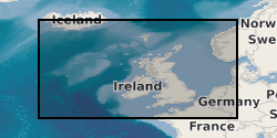
Spatial extent
Provided by
