 NERC Data Catalogue Service
Wyre and Ribble river chemistry in support of Equipt4risk NERC project (NERC Grant NE/R017832/1 )
This data is the analysis of the river water of the paper: Wilson et al. (20 "Compartmentalisation and groundwater–surface water interactions in a prospective shale gas basin: Assessment using variance analysis and multivariate statistics on water quality data" Hydrological Processes 34:3271–3294 (https://onlinelibrary.wiley.com/doi/10.1002/hyp.13795) The data is from two sampling campaigns sampling the rivers of the Wyre and Ribble catchments in north west England. The river water samples were collected to test whether groundwater compartmentalisation observed in the underlying aquifers impacted the surface water quality. The compartmentalisation of the aquifer is important because this has been shown to control the vulnerability of water resources to pollution from facking fluids injected at depths of 1000's m.
Simple
- Date (Creation)
- 2021-04-26
Originator
University of Durham
-
Fred Worrall
(
Professor of Environmental Chemistry
)
Dept of Earth Sciences
,
Durham
,
DH1 3LE
,
Principal investigator
University of Durham
-
Fred Worrall
(
Professor of Environmental Chemistry
)
Dept of Earth Sciences
,
Durham
,
DH1 3LE
,
- Maintenance and update frequency
- notApplicable notApplicable
- GEMET - INSPIRE themes, version 1.0
- BGS Thesaurus of Geosciences
-
- Groundwater
- Surface waters
- Water quality
- NGDC Deposited Data
- Hydraulic fracturing
- dataCentre
- Keywords
-
- NERC_DDC
- Access constraints
- otherRestrictions Other restrictions
- Other constraints
- licenceOGL
- Use constraints
- otherRestrictions Other restrictions
- Other constraints
- The copyright of materials derived from the British Geological Survey's work is vested in the Natural Environment Research Council [NERC]. No part of this work may be reproduced or transmitted in any form or by any means, or stored in a retrieval system of any nature, without the prior permission of the copyright holder, via the BGS Intellectual Property Rights Manager. Use by customers of information provided by the BGS, is at the customer's own risk. In view of the disparate sources of information at BGS's disposal, including such material donated to BGS, that BGS accepts in good faith as being accurate, the Natural Environment Research Council (NERC) gives no warranty, expressed or implied, as to the quality or accuracy of the information supplied, or to the information's suitability for any use. NERC/BGS accepts no liability whatever in respect of loss, damage, injury or other occurence however caused.
- Other constraints
- Available under the Open Government Licence subject to the following acknowledgement accompanying the reproduced NERC materials "Contains NERC materials ©NERC [year]"
- Spatial representation type
- textTable Text, table
- Metadata language
- EnglishEnglish
- Topic category
-
- Geoscientific information
- Geographic identifier
-
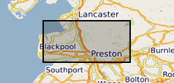
LANCASHIRE [id=154200]
- Date (Creation)
- 1979
N
S
E
W
))
- Begin date
- 2018-07-01
- End date
- 2018-09-30
- Unique resource identifier
- OSGB 1936 / British National Grid (EPSG::27700)
- Distribution format
-
-
Microsoft Excel
()
-
Microsoft Excel
()
- OnLine resource
- Data ( WWW:DOWNLOAD-1.0-http--download )
- Hierarchy level
- dataset Dataset
- Other
- dataset
Conformance result
- Date (Publication)
- 2011
- Explanation
- See the referenced specification
- Pass
- No
Conformance result
- Date (Publication)
- 2010-12-08
- Explanation
- See http://eur-lex.europa.eu/LexUriServ/LexUriServ.do?uri=OJ:L:2010:323:0011:0102:EN:PDF
- Pass
- No
- Statement
- The field campaign was based upon a factorial design to cover both the different rivers, geology and a fault known to compartmentalise the underlying aquifer. Samples were collected upon two field campaigns in July and September 2018. In total , across the two campaigns, 239 separate locations were sampled, some locations were sampled in both campaigns to ensure comparability. All samples were analysed using Inductively Coupled Plasma-Optical Emission Spectrometry (ICP-OES). Of the 239 sample locations, 170 were not tidally influenced and were distributed as: Mercia Mudstone Group (40 samples); Sherwood Sandstone Group(69 samples); Millstone Grit (29 samples); Lower Coal Measures (2 samples); and the Bowland High and Craven Groups (30 samples). Ions measured were: calcium(Ca), iron (Fe), potassium (K), magnesium (Mg), manganese (Mn),sodium (Na) and sulphur (S).
- File identifier
- c11e2d8b-48ad-455d-e054-002128a47908 XML
- Metadata language
- EnglishEnglish
- Hierarchy level
- dataset Dataset
- Date stamp
- 2025-12-11
- Metadata standard name
- UK GEMINI
- Metadata standard version
- 2.3
Point of contact
British Geological Survey
Environmental Science Centre,Keyworth
,
NOTTINGHAM
,
NOTTINGHAMSHIRE
,
NG12 5GG
,
United Kingdom
+44 115 936 3100
- Dataset URI
- http://data.bgs.ac.uk/id/dataHolding/13607745
Overviews
Spatial extent
N
S
E
W
Provided by

Associated resources
Not available