
Groundwater Vulnerability Scotland version 2
Simple
- Date (Creation)
- 2015-10-20
0115 936 3276
0115 936 3276
- Maintenance and update frequency
- asNeeded As needed
- GEMET - INSPIRE themes, version 1.0
- BGS Thesaurus of Geosciences
-
- GIS
- Groundwater
- dataCentre
- Keywords
-
- NERC_DDC
- Access constraints
- otherRestrictions Other restrictions
- Other constraints
- license
- Use constraints
- otherRestrictions Other restrictions
- Other constraints
- The copyright of materials derived from the British Geological Survey's work is vested in the Natural Environment Research Council [NERC]. No part of this work may be reproduced or transmitted in any form or by any means, or stored in a retrieval system of any nature, without the prior permission of the copyright holder, via the BGS Intellectual Property Rights Manager. Use by customers of information provided by the BGS, is at the customer's own risk. In view of the disparate sources of information at BGS's disposal, including such material donated to BGS, that BGS accepts in good faith as being accurate, the Natural Environment Research Council (NERC) gives no warranty, expressed or implied, as to the quality or accuracy of the information supplied, or to the information's suitability for any use. NERC/BGS accepts no liability whatever in respect of loss, damage, injury or other occurence however caused.
- Other constraints
- The dataset is made available to external clients under BGS Digital Data Licence terms and conditions. Revert to the IPR Section (iprdigital@bgs.ac.uk ) if further advice is required with regard to permitted usage.
- Spatial representation type
- vector Vector
- Metadata language
- EnglishEnglish
- Topic category
-
- Geoscientific information
- Geographic identifier
-
SCOTLAND [id=140000]
- Date (Creation)
- 1979
- Geographic identifier
-
SCT
- Date (Revision)
- 2009
))
- End date
- 2015-10-20 Before
- Unique resource identifier
- OSGB 1936 / British National Grid (EPSG::27700)
- Distribution format
-
-
ESRI Shapefile
(
1994
)
-
ESRI Shapefile
(
1994
)
0115 936 3276
- OnLine resource
-
Citation Information - Digital Object Identifier (DOI)
(
WWW:LINK-1.0-http--related
)
British Geological Survey (2015): Groundwater Vulnerability Scotland version 2. British Geological Survey. (Dataset). https://doi.org/10.5285/95759d72-eae9-4b2b-a9ee-589b00a505b2
- OnLine resource
-
Hydrogeological maps of Scotland
(
WWW:LINK-1.0-http--link
)
The BGS has produced a suite of hydrogeological maps of Scotland. The suite comprises two layers: groundwater vulnerability and aquifer productivity (bedrock and superficial).
- Hierarchy level
- dataset Dataset
- Other
- dataset
Conformance result
- Date (Publication)
- 2011
- Explanation
- See the referenced specification
- Pass
- No
Conformance result
- Date (Publication)
- 2010-12-08
- Explanation
- See http://eur-lex.europa.eu/LexUriServ/LexUriServ.do?uri=OJ:L:2010:323:0011:0102:EN:PDF
- Pass
- No
- Statement
- The groundwater vulnerability dataset was produced in ArcGIS by combining a range of environmental datasets using a rule-based method to define a vulnerability classification. Groundwater vulnerability is described by one of five relative classes ranging from 1 (lowest vulnerability) to 5 (highest vulnerability). Input datasets include: BGS Geology 50K (formerly known as DiGMapGB-50 (Digital Geological Map of Great Britain at 1:50 000)) (Bedrock) Version 5.18 Permeability Dataset for Great Britain (Superficial) Version 6.0 (British Geological Survey 2010) Depth to groundwater level in superficial deposits (BGS) Depth to groundwater level in bedrock aquifers (BGS) HOST (Hydrology of Soil Types) Class from the James Hutton Institute (formerly the Macaulay Institute) Superficial deposits thickness (BGS)
- File identifier
- b4eb74f1-88f9-45a5-e054-002128a47908 XML
- Metadata language
- EnglishEnglish
- Hierarchy level
- dataset Dataset
- Date stamp
- 2026-04-01
- Metadata standard name
- UK GEMINI
- Metadata standard version
- 2.3
- Dataset URI
- http://data.bgs.ac.uk/id/dataHolding/13607690
Overviews
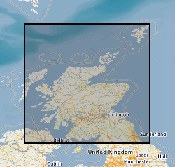
Spatial extent
Provided by
