 NERC Data Catalogue Service
Mining Hazard (not including coal) Great Britain version 8
Simple
- Date (Creation)
- 2020-09-01
0115 936 3276
0115 936 3276
0115 936 3276
- Maintenance and update frequency
- notPlanned Not planned
- GEMET - INSPIRE themes, version 1.0
- BGS Thesaurus of Geosciences
-
- Vein deposits
- Evaporite minerals
- Building stones
- Natural hazards
- Oil shale
- Chalk
- Minerals
- Mining
- Ores
- Underground mining
- dataCentre
- Keywords
-
- NERC_DDC
- Access constraints
- otherRestrictions Other restrictions
- Other constraints
- license
- Use constraints
- otherRestrictions Other restrictions
- Other constraints
- The copyright of materials derived from the British Geological Survey's work is vested in the Natural Environment Research Council [NERC]. No part of this work may be reproduced or transmitted in any form or by any means, or stored in a retrieval system of any nature, without the prior permission of the copyright holder, via the BGS Intellectual Property Rights Manager. Use by customers of information provided by the BGS, is at the customer's own risk. In view of the disparate sources of information at BGS's disposal, including such material donated to BGS, that BGS accepts in good faith as being accurate, the Natural Environment Research Council (NERC) gives no warranty, expressed or implied, as to the quality or accuracy of the information supplied, or to the information's suitability for any use. NERC/BGS accepts no liability whatever in respect of loss, damage, injury or other occurence however caused.
- Other constraints
- The dataset is made available to external clients under BGS Digital Data Licence terms and conditions. Revert to the IPR Section (iprdigital@bgs.ac.uk ) if further advice is required with regard to permitted usage.
- Metadata language
- EnglishEnglish
- Topic category
-
- Geoscientific information
- Geographic identifier
-
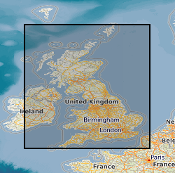
GBN
- Date (Revision)
- 2009
- Geographic identifier
-
GREAT BRITAIN [id=139600]
- Date (Creation)
- 1979
))
- End date
- 2020-09-01 Before
- Unique resource identifier
- OSGB 1936 / British National Grid (EPSG::27700)
- Distribution format
-
-
ESRI Shapefile
(
1994
)
-
ESRI Shapefile
(
1994
)
0115 936 3276
- OnLine resource
-
Datasets
(
WWW:LINK-1.0-http--link
)
This page features a curated list of our most popular and impactful datasets
- OnLine resource
-
Citation Information - Digital Object Identifier (DOI)
(
WWW:LINK-1.0-http--related
)
British Geological Survey (2021): Mining Hazard (not including coal) Great Britain version 8. British Geological Survey. (Dataset). https://doi.org/10.5285/9a558ef2-0081-4e86-917f-ae60b9df40a2
- Hierarchy level
- dataset Dataset
- Other
- dataset
Conformance result
- Date (Publication)
- 2011
- Explanation
- See the referenced specification
- Pass
- No
Conformance result
- Date (Publication)
- 2010-12-08
- Explanation
- See http://eur-lex.europa.eu/LexUriServ/LexUriServ.do?uri=OJ:L:2010:323:0011:0102:EN:PDF
- Pass
- No
- Statement
- Underlying geological content is derived from BGS Geology 50k. Additional information relating to individual mining sites has been obtained as a result of comprehensive literature search. Including data derived from published and unpublished maps, plans and documents held by BGS. Supplementary information has been garnered from expert knowledge. Zones of influence have been calculated using a method created by BGS. This procedure has been derived from the published British Coal methodology. All data processing was carried out using ESRI ArcGIS version 10.3.
- File identifier
- affd0b2f-8e2b-16f9-e054-002128a47908 XML
- Metadata language
- EnglishEnglish
- Hierarchy level
- dataset Dataset
- Date stamp
- 2026-05-06
- Metadata standard name
- UK GEMINI
- Metadata standard version
- 2.3
- Dataset URI
- http://data.bgs.ac.uk/id/dataHolding/13607666
Overviews
Spatial extent
Provided by
