 NERC Data Catalogue Service
UK in-situ stress field orientation from borehole breakouts and drilling induced tensile fractures identified using borehole imaging (2020)
This datasets contains 323 observations of borehole breakouts across and drilling induced tensile fractures from borehole imaging used to re-characterise the UK stress field orientation in 2016. This was published in the Journal of Marine and Petroleum Geology and is openly available using doi:10.1016/j.marpetgeo.2016.02.012 The observations relate to 39 wells from Central and Northern England and are provided with links to screen grabs of the images for clarity. The basic well meta data is supplied along with a description of the dataset. The Images were generated in the IMAGE DISPLAY module of the Landmark RECALL software. and are supplied on an “as shown” basis. Descriptions of the tools and the techniques used are listed in the accompanying paper: KINGDON, A., FELLGETT, M. W. & WILLIAMS, J. D. O. 2016. Use of borehole imaging to improve understanding of the in-situ stress orientation of Central and Northern England and its implications for unconventional hydrocarbon resources. Marine and Petroleum Geology, 73, 1-20.
Simple
- Date (Creation)
- 2020-05
Distributor
British Geological Survey
-
Enquiries
0115 936 3276
Environmental Science Centre, Nicker Hill, Keyworth
,
NOTTINGHAM
,
NOTTINGHAMSHIRE
,
NG12 5GG
,
United Kingdom
0115 936 3143
0115 936 3276
Point of contact
British Geological Survey
-
Enquiries
0115 936 3276
Environmental Science Centre, Nicker Hill, Keyworth
,
NOTTINGHAM
,
NOTTINGHAMSHIRE
,
NG12 5GG
,
United Kingdom
0115 936 3143
0115 936 3276
- Maintenance and update frequency
- unknown Unknown
- GEMET - INSPIRE themes, version 1.0
- BGS Thesaurus of Geosciences
-
- Boreholes
- Fractured rock
- Stress field
- Borehole imaging
- dataCentre
- Keywords
-
- NERC_DDC
- Access constraints
- otherRestrictions Other restrictions
- Other constraints
- licenceOGL
- Use constraints
- otherRestrictions Other restrictions
- Other constraints
- The copyright of materials derived from the British Geological Survey's work is vested in the Natural Environment Research Council [NERC]. No part of this work may be reproduced or transmitted in any form or by any means, or stored in a retrieval system of any nature, without the prior permission of the copyright holder, via the BGS Intellectual Property Rights Manager. Use by customers of information provided by the BGS, is at the customer's own risk. In view of the disparate sources of information at BGS's disposal, including such material donated to BGS, that BGS accepts in good faith as being accurate, the Natural Environment Research Council (NERC) gives no warranty, expressed or implied, as to the quality or accuracy of the information supplied, or to the information's suitability for any use. NERC/BGS accepts no liability whatever in respect of loss, damage, injury or other occurence however caused.
- Other constraints
- Available under the Open Government Licence subject to the following acknowledgement accompanying the reproduced NERC materials "Contains NERC materials ©NERC [year]"
- Metadata language
- EnglishEnglish
- Topic category
-
- Geoscientific information
- Geographic identifier
-
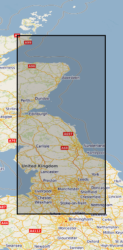
CENTRAL ENGLAND [id=157000]
- Date (Creation)
- 1979
- Geographic identifier
-
NORTHERN ENGLAND [id=151000]
- Date (Creation)
- 1979
- Geographic identifier
-
SCOTLAND [id=140000]
- Date (Creation)
- 1979
- Geographic identifier
-
SCT
- Date (Revision)
- 2009
N
S
E
W
))
- Begin date
- 1980
- End date
- 2010
- Unique resource identifier
- OSGB 1936 / British National Grid (EPSG::27700)
- Distribution format
-
-
PDF
(
witheld
)
-
Microsoft Excel
(
witheld
)
-
PDF
(
witheld
)
Distributor
British Geological Survey
-
Enquiries
0115 936 3276
Environmental Science Centre, Nicker Hill, Keyworth
,
NOTTINGHAM
,
NOTTINGHAMSHIRE
,
NG12 5GG
,
United Kingdom
0115 936 3143
0115 936 3276
- OnLine resource
-
BGS Homepage
(
WWW:LINK-1.0-http--link
)
The BGS Homepage is an entry point to the BGS data services.
- Hierarchy level
- dataset Dataset
- Other
- dataset
Conformance result
- Date (Publication)
- 2011
- Explanation
- See the referenced specification
- Pass
- No
Conformance result
- Date (Publication)
- 2010-12-08
- Explanation
- See http://eur-lex.europa.eu/LexUriServ/LexUriServ.do?uri=OJ:L:2010:323:0011:0102:EN:PDF
- Pass
- No
- Statement
- The images were derived from raw: Las, Lis and Dlis files held on the S drive. They were processed using the Landmark Recall Software. The breakouts and drilling induced tensile fractures were interpreted by Mark Fellgett and Andy Kingdon using the IMAGE DISPLAY module of the RECALL software.
- File identifier
- a716e0b7-23ce-5ff8-e054-002128a47908 XML
- Metadata language
- EnglishEnglish
- Hierarchy level
- dataset Dataset
- Date stamp
- 2026-05-06
- Metadata standard name
- UK GEMINI
- Metadata standard version
- 2.3
Point of contact
British Geological Survey
Environmental Science Centre, Keyworth
,
NOTTINGHAM
,
NOTTINGHAMSHIRE
,
NG12 5GG
,
United Kingdom
+44 115 936 3100
- Dataset URI
- http://data.bgs.ac.uk/id/dataHolding/13607623
Overviews
Spatial extent
N
S
E
W
Provided by

Associated resources
Not available