 NERC Data Catalogue Service
Indicative atlas of radon potential for Great Britain version 2
Simple
- Date (Creation)
- 2011
0115 936 3276
0115 936 3276
0115 936 3276
- Maintenance and update frequency
- irregular Irregular
- GEMET - INSPIRE themes, version 1.0
- BGS Thesaurus of Geosciences
-
- Citable Data
- Radon detection
- Natural hazards
- UK Location (INSPIRE)
- Geochemistry
- Geology
- dataCentre
- Keywords
-
- NERC_DDC
- Access constraints
- otherRestrictions Other restrictions
- Other constraints
- license
- Use constraints
- otherRestrictions Other restrictions
- Other constraints
- The copyright of materials derived from the British Geological Survey's work is vested in the Natural Environment Research Council [NERC]. No part of this work may be reproduced or transmitted in any form or by any means, or stored in a retrieval system of any nature, without the prior permission of the copyright holder, via the BGS Intellectual Property Rights Manager. Use by customers of information provided by the BGS, is at the customer's own risk. In view of the disparate sources of information at BGS's disposal, including such material donated to BGS, that BGS accepts in good faith as being accurate, the Natural Environment Research Council (NERC) gives no warranty, expressed or implied, as to the quality or accuracy of the information supplied, or to the information's suitability for any use. NERC/BGS accepts no liability whatever in respect of loss, damage, injury or other occurence however caused.
- Other constraints
- The dataset is made available to external clients under BGS Digital Data Licence terms and conditions. Revert to the IPR Section (iprdigital@bgs.ac.uk ) if further advice is required with regard to permitted usage.
- Spatial representation type
- vector Vector
- Denominator
- 50000
- Metadata language
- EnglishEnglish
- Topic category
-
- Geoscientific information
- Geographic identifier
-
GBN
- Date (Revision)
- 2009
- Geographic identifier
-
GREAT BRITAIN [id=139600]
- Date (Creation)
- 1979
))
- Begin date
- 2007
- End date
- 2011
- Supplemental Information
- The method by which the PHE-BGS joint Radon Potential Dataset for Great Britain was produced is published in: MILES, J.C.H, and APPLETON J.D., 2005. Mapping variation in radon potential both between and within geological units. Journal of Radiological Protection 25, 257-276.
- Unique resource identifier
- OSGB 1936 / British National Grid (EPSG::27700)
- Distribution format
-
-
ESRI Shapefile
()
-
ESRI Shapefile
()
0115 936 3276
- OnLine resource
-
Citation Information - Digital Object Identifier (DOI)
(
WWW:LINK-1.0-http--related
)
British Geological Survey, Public Health England (2011): Indicative atlas of radon potential for Great Britain version 2. (Dataset). https://doi.org/10.5285/a54a08a9-90ba-4288-a780-e27165aef8c4
- OnLine resource
-
BGS Datasets - Radon data: Indicative Atlas of Radon
(
WWW:LINK-1.0-http--link
)
The Radon potential dataset for the United Kingdom provides the current definitive map of radon-affected areas in the United Kingdom. This data presents a simplified version of the radon potential dataset with each 1 km-grid square being classed according to the highest radon potential found within it, so is indicative rather than definitive.
- Hierarchy level
- dataset Dataset
- Other
- dataset
Conformance result
- Date (Publication)
- 2011
- Explanation
- See the referenced specification
- Pass
- No
Conformance result
- Date (Publication)
- 2010-12-08
- Explanation
- See http://eur-lex.europa.eu/LexUriServ/LexUriServ.do?uri=OJ:L:2010:323:0011:0102:EN:PDF
- Pass
- No
- Statement
- The method by which the PHE-BGS joint Radon Potential for Great Britain was produced is published in: MILES, J.C.H, and APPLETON J.D., 2005. Mapping variation in radon potential both between and within geological units. Journal of Radiological Protection 25, 257-276.
- File identifier
- 9df8df53-2ade-37a8-e044-0003ba9b0d98 XML
- Metadata language
- EnglishEnglish
- Hierarchy level
- dataset Dataset
- Date stamp
- 2025-12-11
- Metadata standard name
- UK GEMINI
- Metadata standard version
- 2.3
- Dataset URI
- http://data.bgs.ac.uk/id/dataHolding/13605540
Overviews
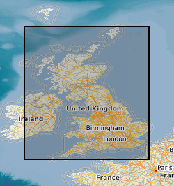
Spatial extent
Provided by
