 NERC Data Catalogue Service
Mineral Reconnaissance Programme (MRP) reports
Simple
- Date (Creation)
- 1972
0115 936 3276
0115 936 3276
- Maintenance and update frequency
- asNeeded As needed
- GEMET - INSPIRE themes, version 1.0
- BGS Thesaurus of Geosciences
-
- Economic geology
- Minerals
- Ore reserves
- Geophysics
- Geochemistry
- Mineral resources
- Geophysical surveys
- Metallogenesis
- dataCentre
- Keywords
-
- NERC_DDC
- Access constraints
- otherRestrictions Other restrictions
- Other constraints
- no limitations
- Other constraints
- The dataset is made freely available for access, e.g. via the Internet. Either no third party data / information is contained in the dataset or BGS has secured written permission from the owner(s) of any third party data / information contained in the dataset to make the dataset freely accessible.
- Use constraints
- otherRestrictions Other restrictions
- Other constraints
- The copyright of materials derived from the British Geological Survey's work is vested in the Natural Environment Research Council [NERC]. No part of this work may be reproduced or transmitted in any form or by any means, or stored in a retrieval system of any nature, without the prior permission of the copyright holder, via the BGS Intellectual Property Rights Manager. Use by customers of information provided by the BGS, is at the customer's own risk. In view of the disparate sources of information at BGS's disposal, including such material donated to BGS, that BGS accepts in good faith as being accurate, the Natural Environment Research Council (NERC) gives no warranty, expressed or implied, as to the quality or accuracy of the information supplied, or to the information's suitability for any use. NERC/BGS accepts no liability whatever in respect of loss, damage, injury or other occurence however caused.
- Other constraints
- Available under the Open Government Licence subject to the following acknowledgement accompanying the reproduced NERC materials "Contains NERC materials ©NERC [year]"
- Spatial representation type
- vector Vector
- Metadata language
- EnglishEnglish
- Topic category
-
- Geoscientific information
- Geographic identifier
-
GBN
- Date (Revision)
- 2009
- Geographic identifier
-
GREAT BRITAIN [id=139600]
- Date (Creation)
- 1979
))
- Begin date
- 1972
- End date
- 1997 Before
- Unique resource identifier
- OSGB 1936 / British National Grid (EPSG::27700)
- Distribution format
-
-
Adobe Acrobat document (PDF)
()
-
Adobe Acrobat document (PDF)
()
0115 936 3276
- OnLine resource
-
GeoIndex_Onshore_minerals_wms
(
OGC:WMS
)
One or more layers for the dataset is provided through this OGC WMS (view) service. This URL is the service end-point and is intended for consumption by software clients that understand the WMS API.
- OnLine resource
- GeoIndex Onshore: Mineral Reconnaissance Programme ( WWW:LINK-1.0-http--link )
- OnLine resource
-
GeoIndex_Onshore_minerals_wms
(
OGC:WMS-1.3.0-http-get-capabilities
)
One or more layers for the dataset is provided through this OGC WMS (view) service.
- OnLine resource
- Mineral Reconnaissance Programme (MRP) reports - MineralsUK – Exploration and maps ( WWW:LINK-1.0-http--link )
- Hierarchy level
- dataset Dataset
- Other
- dataset
Conformance result
- Date (Publication)
- 2011
- Explanation
- See the referenced specification
- Pass
- No
Conformance result
- Date (Publication)
- 2010-12-08
- Explanation
- See http://eur-lex.europa.eu/LexUriServ/LexUriServ.do?uri=OJ:L:2010:323:0011:0102:EN:PDF
- Pass
- No
- Statement
- The original data are Mineral Reconnaissance Programme Reports created as part of the Mineral Reconnaissance Programme. Scans of the reports were published via the NERC Open Research Archive (NORA) in 2023.
- File identifier
- 9df8df53-2a8b-37a8-e044-0003ba9b0d98 XML
- Metadata language
- EnglishEnglish
- Hierarchy level
- dataset Dataset
- Date stamp
- 2026-05-06
- Metadata standard name
- UK GEMINI
- Metadata standard version
- 2.3
- Dataset URI
- http://data.bgs.ac.uk/id/dataHolding/13605457
Overviews
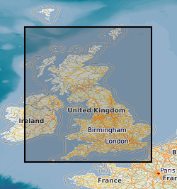
Spatial extent
Provided by
