 NERC Data Catalogue Service
Digital Geological Map Data of Great Britain - 50k (DiGMapGB-50) version 7
Simple
- Date (Creation)
- 2013
0115 936 3276
0115 936 3276
0115 936 3276
0115 936 3276
- Maintenance and update frequency
- asNeeded As needed
- GEMET - INSPIRE themes, version 1.0
- BGS Thesaurus of Geosciences
-
- UK Location (INSPIRE)
- Digital maps
- Maps
- Geology
- Scottish SDI
- GIS
- Data
- dataCentre
- Keywords
-
- NERC_DDC
- Access constraints
- otherRestrictions Other restrictions
- Other constraints
- license
- Use constraints
- otherRestrictions Other restrictions
- Other constraints
- The copyright of materials derived from the British Geological Survey's work is vested in the Natural Environment Research Council [NERC]. No part of this work may be reproduced or transmitted in any form or by any means, or stored in a retrieval system of any nature, without the prior permission of the copyright holder, via the BGS Intellectual Property Rights Manager. Use by customers of information provided by the BGS, is at the customer's own risk. In view of the disparate sources of information at BGS's disposal, including such material donated to BGS, that BGS accepts in good faith as being accurate, the Natural Environment Research Council (NERC) gives no warranty, expressed or implied, as to the quality or accuracy of the information supplied, or to the information's suitability for any use. NERC/BGS accepts no liability whatever in respect of loss, damage, injury or other occurence however caused.
- Other constraints
- The dataset is made available to external clients under BGS Digital Data Licence terms and conditions. Revert to the IPR Section (iprdigital@bgs.ac.uk ) if further advice is required with regard to permitted usage.
- Spatial representation type
- vector Vector
- Denominator
- 50000
- Metadata language
- EnglishEnglish
- Topic category
-
- Geoscientific information
- Geographic identifier
-
GBN
- Date (Revision)
- 2009
- Geographic identifier
-
GREAT BRITAIN [id=139600]
- Date (Creation)
- 1979
))
- End date
- 2013 Before
- Unique resource identifier
- OSGB 1936 / British National Grid (EPSG::27700)
- Distribution format
-
-
ESRI shapefiles
()
-
ESRI shapefiles
()
0115 936 3276
- OnLine resource
-
DiGMapGB-50
More information on the DiGMapGB-50 dataset is available via this URL.
- OnLine resource
-
British geology onshore digital maps 1:50 000 scale | DiGMapGB-50 WMS
The WMS layer can be accessed by entering this URL address below into your WMS client. The service supports the British National Grid and Lat/Long WGS84 coordinate systems and the data is visible when zoomed in between 1:100 000 and 1:25 000 scale.
- OnLine resource
-
British geology onshore digital maps 1:50 000 scale | DiGMapGB-50 WMS
Information about the DiGMapGB-50 WMS layer can be viewed via the web page this URL links to.
- Hierarchy level
- dataset Dataset
- Other
- dataset
Conformance result
- Date (Publication)
- 2011
- Explanation
- See the referenced specification
- Pass
- No
Conformance result
- Date (Publication)
- 2010-12-08
- Explanation
- See http://eur-lex.europa.eu/LexUriServ/LexUriServ.do?uri=OJ:L:2010:323:0011:0102:EN:PDF
- Pass
- No
- Statement
- The data shows polygonal and selected linear geological information, primarily sourced from published BGS 1:50 000 or 1:63 360 scale maps. For further lineage information see Digital Geological Map of Great Britain, information notes, 2013, http://www.bgs.ac.uk/downloads/start.cfm?id=644
- File identifier
- 9df8df52-d7d1-37a8-e044-0003ba9b0d98 XML
- Metadata language
- EnglishEnglish
- Hierarchy level
- dataset Dataset
- Date stamp
- 2025-05-13
- Metadata standard name
- UK GEMINI
- Metadata standard version
- 2.3
- Dataset URI
- http://data.bgs.ac.uk/id/dataHolding/13480428
Overviews
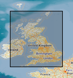
Spatial extent
Provided by
