 NERC Data Catalogue Service
Regional gravity survey data of onshore and nearshore United Kingdom
Simple
- Date (Creation)
- 1948
0115 936 3276
0115 936 3276
0115 936 3276
0115 936 3276
0115 936 3276
- Maintenance and update frequency
- irregular Irregular
- GEMET - INSPIRE themes, version 1.0
- BGS Thesaurus of Geosciences
-
- Gravity
- Geophysical surveys
- Geophysics
- Geology
- Gravity surveys
- dataCentre
- Keywords
-
- NERC_DDC
- Access constraints
- otherRestrictions Other restrictions
- Other constraints
- licenceOGL
- Use constraints
- otherRestrictions Other restrictions
- Other constraints
- The copyright of materials derived from the British Geological Survey's work is vested in the Natural Environment Research Council [NERC]. No part of this work may be reproduced or transmitted in any form or by any means, or stored in a retrieval system of any nature, without the prior permission of the copyright holder, via the BGS Intellectual Property Rights Manager. Use by customers of information provided by the BGS, is at the customer's own risk. In view of the disparate sources of information at BGS's disposal, including such material donated to BGS, that BGS accepts in good faith as being accurate, the Natural Environment Research Council (NERC) gives no warranty, expressed or implied, as to the quality or accuracy of the information supplied, or to the information's suitability for any use. NERC/BGS accepts no liability whatever in respect of loss, damage, injury or other occurence however caused.
- Other constraints
- Available under the Open Government Licence subject to the following acknowledgement accompanying the reproduced NERC materials "Contains NERC materials ©NERC [year]"
- Spatial representation type
- textTable Text, table
- Metadata language
- EnglishEnglish
- Topic category
-
- Geoscientific information
- Geographic identifier
-
GB
- Date (Revision)
- 2009
- Geographic identifier
-
UK [id=139300]
- Date (Creation)
- 1979
- Geographic identifier
-
UKM
- Date (Revision)
- 2009
))
- Begin date
- 1948
- Supplemental Information
- Dataset updated as data becomes available. Child of Regional Gravity Surveys of Onshore and Nearshore United Kingdom. Bounding rectangle approx 50% covered (mainly land areas) Average station density of 1-2 per square kilometre onshore; sparser sea bottom stations in the Irish Sea and Firth of Clyde. Data quality largely consistent, terrain corrections applied only in hilly arees
- Unique resource identifier
- OSGB 1936 / British National Grid (EPSG::27700)
- Unique resource identifier
- TM65 / Irish National Grid (EPSG::29900)
- Distribution format
-
-
Comma-Separated Values (CSV) file (.csv)
()
-
Comma-Separated Values (CSV) file (.csv)
()
0115 936 3276
0115 936 3276
- OnLine resource
-
Great Britain land gravity survey
(
WWW:LINK-1.0-http--link
)
This dataset comprises over 165000 gravity observations on onshore Great Britain. Most of the surveys were carried out by the BGS but the dataset includes data originally acquired by other organisations. This was subsequently given to the BGS and integrated into a consistent dataset that became a national archive.
- Hierarchy level
- dataset Dataset
- Other
- dataset
Conformance result
- Date (Publication)
- 2011
- Explanation
- See the referenced specification
- Pass
- No
Conformance result
- Date (Publication)
- 2010-12-08
- Explanation
- See http://eur-lex.europa.eu/LexUriServ/LexUriServ.do?uri=OJ:L:2010:323:0011:0102:EN:PDF
- Pass
- No
- Statement
- Data predominantly acquired by BGS but other data from commercial and academic organisations. This was subsequently given to the BGS and integrated into a consistent dataset that became a national archive.
- File identifier
- 9df8df51-6404-37a8-e044-0003ba9b0d98 XML
- Metadata language
- EnglishEnglish
- Hierarchy level
- dataset Dataset
- Date stamp
- 2026-04-30
- Metadata standard name
- UK GEMINI
- Metadata standard version
- 2.3
- Dataset URI
- http://data.bgs.ac.uk/id/dataHolding/13480466
Overviews
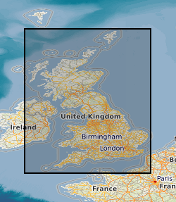
Spatial extent
Provided by
