 NERC Data Catalogue Service
Groundwater Level Archive
Database of water levels in selected observation boreholes: daily, weekly or monthly measurements. Consistent set of boreholes in catchments relatively undisturbed by pumping distributed across most significant aquifer units in the UK. Most sites have more than 30 years of data, and some sites have considerably longer time series. The dataset represents only 5% of active groundwater monitoring networks run by UK measuring agencies. BGS holds other, historical, groundwater level data, including one off measurements and time series.
Simple
- Date (Creation)
- 1983
Distributor
British Geological Survey
-
Enquiries
01491 692345
Maclean Building, Crowmarsh Gifford
,
WALLINGFORD
,
OXON
,
OX10 8BB
,
United Kingdom
01491 838800
01491 692345
Originator
British Geological Survey
-
Enquiries
01491 692345
Maclean Building, Crowmarsh Gifford
,
WALLINGFORD
,
OXON
,
OX10 8BB
,
United Kingdom
01491 838800
01491 692345
- Maintenance and update frequency
- monthly Monthly
- GEMET - INSPIRE themes, version 1.0
- BGS Thesaurus of Geosciences
-
- Aquifers
- General geology
- Geology
- Water
- Groundwater
- UK Location (INSPIRE)
- Hydrogeology
- dataCentre
- Keywords
-
- NERC_DDC
- Access constraints
- otherRestrictions Other restrictions
- Other constraints
- Data provision subject to standard BGS charges.
- Use constraints
- otherRestrictions Other restrictions
- Other constraints
- The copyright of materials derived from the British Geological Survey's work is vested in the Natural Environment Research Council [NERC]. No part of this work may be reproduced or transmitted in any form or by any means, or stored in a retrieval system of any nature, without the prior permission of the copyright holder, via the BGS Intellectual Property Rights Manager. Use by customers of information provided by the BGS, is at the customer's own risk. In view of the disparate sources of information at BGS's disposal, including such material donated to BGS, that BGS accepts in good faith as being accurate, the Natural Environment Research Council (NERC) gives no warranty, expressed or implied, as to the quality or accuracy of the information supplied, or to the information's suitability for any use. NERC/BGS accepts no liability whatever in respect of loss, damage, injury or other occurence however caused.
- Other constraints
- Either: (i) the dataset is made freely available, e.g. via the Internet, for a restricted category of use (e.g. educational use only); or (ii) the dataset has not been formally approved by BGS for access and use by external clients under licence, but its use may be permitted under alternative formal arrangements; or (iii) the dataset contains 3rd party data or information obtained by BGS under terms and conditions that must be consulted in order to determine the permitted usage of the dataset. Refer to the BGS staff member responsible for the creation of the dataset if further advice is required. He / she should be familiar with the composition of the dataset, particularly with regard to 3rd party IPR contained in it, and any resultant use restrictions. This staff member should revert to the IPR Section (ipr@bgs.ac.uk ) for advice, should the position not be clear.
- Denominator
- 10000
- Metadata language
- EnglishEnglish
- Topic category
-
- Geoscientific information
- Geographic identifier
-
GB
- Date (Revision)
- 2009
- Geographic identifier
-
UK [id=139300]
- Date (Creation)
- 1979
- Geographic identifier
-
UKM
- Date (Revision)
- 2009
N
S
E
W
))
- Begin date
- 1983
- Supplemental Information
- New data entered as received. High resolution data may be available at some sites. Many of the historical records are at sites that are no longer actively monitored. Monitoring mostly in major aquifers, with approximately one borehole per Water Framework Directive Groundwater Body.
- Unique resource identifier
- OSGB 1936 / British National Grid (EPSG::27700)
- Distribution format
-
-
DIGITAL - Digital format
(
witheld
)
-
DIGITAL - Digital format
(
witheld
)
Distributor
British Geological Survey
-
Enquiries
01491 692345
Maclean Building, Crowmarsh Gifford
,
WALLINGFORD
,
OXON
,
OX10 8BB
,
United Kingdom
01491 838800
01491 692345
- OnLine resource
-
BGS Homepage
(
WWW:LINK-1.0-http--link
)
The BGS Homepage is an entry point to the BGS data services.
- Hierarchy level
- dataset Dataset
- Other
- dataset
Conformance result
- Date (Publication)
- 2011
- Explanation
- See the referenced specification
- Pass
- No
Conformance result
- Date (Publication)
- 2010-12-08
- Explanation
- See http://eur-lex.europa.eu/LexUriServ/LexUriServ.do?uri=OJ:L:2010:323:0011:0102:EN:PDF
- Pass
- No
- Statement
- Data from EA, SEPA and other measuring agencies.
- File identifier
- 9df8df51-63e8-37a8-e044-0003ba9b0d98 XML
- Metadata language
- EnglishEnglish
- Hierarchy level
- dataset Dataset
- Date stamp
- 2025-12-15
- Metadata standard name
- UK GEMINI
- Metadata standard version
- 2.3
Point of contact
British Geological Survey
Maclean Building, Crowmarsh Gifford
,
WALLINGFORD
,
OXON
,
OX10 8BB
,
United Kingdom
+44 115 936 3100
- Dataset URI
- http://data.bgs.ac.uk/id/dataHolding/13480430
Overviews
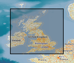
Spatial extent
N
S
E
W
Provided by

Associated resources
Not available