 NERC Data Catalogue Service
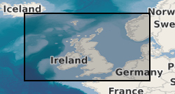
Airborne Magnetic Survey Records for United Kingdom and Adjacent Areas
Simple
- Date (Creation)
- 1955
0115 936 3276
0115 936 3276
0115 936 3276
0115 936 3276
0115 936 3276
- Maintenance and update frequency
- irregular Irregular
- GEMET - INSPIRE themes, version 1.0
- BGS Thesaurus of Geosciences
-
- Aerial magnetic surveys
- Geology
- Aerial geophysical surveys
- Geophysical surveys
- Geophysics
- Magnetic surveys
- dataCentre
- Keywords
-
- NERC_DDC
- Access constraints
- otherRestrictions Other restrictions
- Other constraints
- Charges apply.
- Use constraints
- otherRestrictions Other restrictions
- Other constraints
- The copyright of materials derived from the British Geological Survey's work is vested in the Natural Environment Research Council [NERC]. No part of this work may be reproduced or transmitted in any form or by any means, or stored in a retrieval system of any nature, without the prior permission of the copyright holder, via the BGS Intellectual Property Rights Manager. Use by customers of information provided by the BGS, is at the customer's own risk. In view of the disparate sources of information at BGS's disposal, including such material donated to BGS, that BGS accepts in good faith as being accurate, the Natural Environment Research Council (NERC) gives no warranty, expressed or implied, as to the quality or accuracy of the information supplied, or to the information's suitability for any use. NERC/BGS accepts no liability whatever in respect of loss, damage, injury or other occurence however caused.
- Other constraints
- Either: (i) the dataset is made freely available, e.g. via the Internet, for a restricted category of use (e.g. educational use only); or (ii) the dataset has not been formally approved by BGS for access and use by external clients under licence, but its use may be permitted under alternative formal arrangements; or (iii) the dataset contains 3rd party data or information obtained by BGS under terms and conditions that must be consulted in order to determine the permitted usage of the dataset. Refer to the BGS staff member responsible for the creation of the dataset if further advice is required. He / she should be familiar with the composition of the dataset, particularly with regard to 3rd party IPR contained in it, and any resultant use restrictions. This staff member should revert to the IPR Section (ipr@bgs.ac.uk ) for advice, should the position not be clear.
- Denominator
- 63360
- Metadata language
- EnglishEnglish
- Topic category
-
- Geoscientific information
- Geographic identifier
-
GB
- Date (Revision)
- 2009
- Geographic identifier
-
UK CONTINENTAL SHELF [id=121701]
- Date (Creation)
- 1979
- Geographic identifier
-
UK [id=139300]
- Date (Creation)
- 1979
- Geographic identifier
-
UKM
- Date (Revision)
- 2009
))
- Begin date
- 1955
- End date
- 1965
- Supplemental Information
- Data capture ended in 1965 but the dataset is updated as new data becomes available. PUBLICATION: THE DIGITAL AEROMAGNETIC SURVEY OF THE UNITED KINGDOM 1989. BRITISH GEOLOGICAL SURVEY TECHNICAL REPORT
Reference System Information
- Distribution format
-
-
OTHER, UNKNOWN OR OBSCURE - Record listings, grids
(
witheld
)
-
Digital - Digital records
(
witheld
)
-
Hardcopy - The paper chart records are old and fragile and do not photocopy well
()
-
Hardcopy - Contour maps
()
-
OTHER, UNKNOWN OR OBSCURE - Record listings, grids
(
witheld
)
0115 936 3276
0115 936 3276
- OnLine resource
-
Great Britain aeromagnetic survey
(
WWW:LINK-1.0-http--link
)
The regional aeromagnetic data for Great Britain was acquired by Hunting Geology and Geophysics Ltd and Canadian Aeroservices Ltd between 1955 and 1965.
- Hierarchy level
- dataset Dataset
- Other
- dataset
Conformance result
- Date (Publication)
- 2011
- Explanation
- See the referenced specification
- Pass
- No
Conformance result
- Date (Publication)
- 2010-12-08
- Explanation
- See http://eur-lex.europa.eu/LexUriServ/LexUriServ.do?uri=OJ:L:2010:323:0011:0102:EN:PDF
- Pass
- No
- Statement
- Flight line records, worksheets, contoured maps, aerial photographs provided by contractors at completion of each BGS survey. Other surveys acquired from companies on tape.
- File identifier
- 9df8df51-639e-37a8-e044-0003ba9b0d98 XML
- Metadata language
- EnglishEnglish
- Hierarchy level
- dataset Dataset
- Date stamp
- 2026-05-03
- Metadata standard name
- UK GEMINI
- Metadata standard version
- 2.3
- Dataset URI
- http://data.bgs.ac.uk/id/dataHolding/13480327
Overviews
Spatial extent
Provided by
