 NERC Data Catalogue Service
Mines and quarries database - BritPits
List of mines and quarries in the UK including information about operational status, products, lithostratigraphy, chronostratigraphy, pit and operator addresses, minerals planning authority. Digital data has been sold from the BritPits database, since 1994, this has been customised to suit purchasers. Use is also made of sets of operational workings data by Bureau Services who pay royalties and get updates. Older data on operators tends to be incomplete as it was not recorded. Updating is ongoing to update litho- and chronostrat data. Originally, only details of currently active sites were included in the database but, because of the importance of former workings for waste disposal and as Sites of Special Scientific Interest, information is now collected on both inactive and closed operations. The data is held in a relational database using an Oracle server and a Microsoft Access front-end. The database can be used for many purposes: mailing lists, route planning, market intelligence/analysis, and resource planning, and data has been supplied to a wide range of customers.
Simple
- Date (Creation)
- 1987
Distributor
British Geological Survey
-
Enquiries
0115 936 3276
Environmental Science Centre, Nicker Hill, Keyworth
,
NOTTINGHAM
,
NOTTINGHAMSHIRE
,
NG12 5GG
,
United Kingdom
0115 936 3143
0115 936 3276
Originator
British Geological Survey
-
Enquiries
0115 936 3276
Environmental Science Centre, Nicker Hill, Keyworth
,
NOTTINGHAM
,
NOTTINGHAMSHIRE
,
NG12 5GG
,
United Kingdom
0115 936 3143
0115 936 3276
Point of contact
British Geological Survey
-
Enquiries
0115 936 3276
Environmental Science Centre, Nicker Hill, Keyworth
,
NOTTINGHAM
,
NOTTINGHAMSHIRE
,
NG12 5GG
,
United Kingdom
0115 936 3143
0115 936 3276
Custodian
British Geological Survey
-
Enquiries
0115 936 3276
Environmental Science Centre, Nicker Hill, Keyworth
,
NOTTINGHAM
,
NOTTINGHAMSHIRE
,
NG12 5GG
,
United Kingdom
0115 936 3143
0115 936 3276
- Maintenance and update frequency
- irregular Irregular
- GEMET - INSPIRE themes, version 1.0
- BGS Thesaurus of Geosciences
-
- Quarrying
- Mines
- Mining
- Open cut mining
- Sand pits
- Commodity economics
- dataCentre
- Keywords
-
- NERC_DDC
- Access constraints
- otherRestrictions Other restrictions
- Use constraints
- otherRestrictions Other restrictions
- Other constraints
- The copyright of materials derived from the British Geological Survey's work is vested in the Natural Environment Research Council [NERC]. No part of this work may be reproduced or transmitted in any form or by any means, or stored in a retrieval system of any nature, without the prior permission of the copyright holder, via the BGS Intellectual Property Rights Manager. Use by customers of information provided by the BGS, is at the customer's own risk. In view of the disparate sources of information at BGS's disposal, including such material donated to BGS, that BGS accepts in good faith as being accurate, the Natural Environment Research Council (NERC) gives no warranty, expressed or implied, as to the quality or accuracy of the information supplied, or to the information's suitability for any use. NERC/BGS accepts no liability whatever in respect of loss, damage, injury or other occurence however caused.
- Other constraints
- Either: (i) the dataset is made freely available, e.g. via the Internet, for a restricted category of use (e.g. educational use only); or (ii) the dataset has not been formally approved by BGS for access and use by external clients under licence, but its use may be permitted under alternative formal arrangements; or (iii) the dataset contains 3rd party data or information obtained by BGS under terms and conditions that must be consulted in order to determine the permitted usage of the dataset. Refer to the BGS staff member responsible for the creation of the dataset if further advice is required. He / she should be familiar with the composition of the dataset, particularly with regard to 3rd party IPR contained in it, and any resultant use restrictions. This staff member should revert to the IPR Section (ipr@bgs.ac.uk ) for advice, should the position not be clear.
- Spatial representation type
- grid Grid
- Denominator
- 10000
- Metadata language
- EnglishEnglish
- Topic category
-
- Geoscientific information
- Geographic identifier
-
GB
- Date (Revision)
- 2009
- Geographic identifier
-
UK [id=139300]
- Date (Creation)
- 1979
- Geographic identifier
-
UKM
- Date (Revision)
- 2009
N
S
E
W
))
- Begin date
- 1835
- Supplemental Information
- Started for use in Directory of Mines and Quarries 1987 edition. Updated irregularly, as and when information comes in, e.g. as part of other projects. Major updates have been triennial in past.
- Unique resource identifier
- OSGB 1936 / British National Grid (EPSG::27700)
- Unique resource identifier
- TM65 / Irish National Grid (EPSG::29900)
- Distribution format
-
-
BOOKS - Published information on operational workings as Directory of Mines and Quarries latest edition 1998.
(
witheld
)
-
BOOKS - Published information on operational workings as Directory of Mines and Quarries latest edition 1998.
(
witheld
)
Distributor
British Geological Survey
-
Enquiries
0115 936 3276
Environmental Science Centre, Nicker Hill, Keyworth
,
NOTTINGHAM
,
NOTTINGHAMSHIRE
,
NG12 5GG
,
United Kingdom
0115 936 3143
0115 936 3276
- OnLine resource
-
GeoIndex Onshore
(
WWW:LINK-1.0-http--link
)
BGS GeoIndex is a web tool for professional users who need to access BGS data as part of their business requirements. The map viewer is free to use and is designed to work on desktop and mobile devices.
- OnLine resource
- BGS Datasets - BritPits ( WWW:LINK-1.0-http--link )
- Hierarchy level
- dataset Dataset
- Other
- dataset
Conformance result
- Date (Publication)
- 2011
- Explanation
- See the referenced specification
- Pass
- No
Conformance result
- Date (Publication)
- 2010-12-08
- Explanation
- See http://eur-lex.europa.eu/LexUriServ/LexUriServ.do?uri=OJ:L:2010:323:0011:0102:EN:PDF
- Pass
- No
- Statement
- Has carried on from Directory of MInes and Quarries book started 1800s. Data is gathered from a number of sources: BGS's own extensive records, Mineral Planning Authorities (MPAs), the minerals industry and various central Government Departments and Agencies (ODPM, Coal Authority, etc).
- File identifier
- 9df8df51-637b-37a8-e044-0003ba9b0d98 XML
- Metadata language
- EnglishEnglish
- Hierarchy level
- dataset Dataset
- Date stamp
- 2026-05-06
- Metadata standard name
- UK GEMINI
- Metadata standard version
- 2.3
Point of contact
British Geological Survey
Environmental Science Centre,Keyworth
,
NOTTINGHAM
,
NOTTINGHAMSHIRE
,
NG12 5GG
,
United Kingdom
+44 115 936 3100
- Dataset URI
- http://data.bgs.ac.uk/id/dataHolding/13480276
Overviews
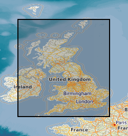
Spatial extent
N
S
E
W
Provided by

Associated resources
Not available