 NERC Data Catalogue Service
Pelite Illite crystallinity database
Simple
- Date (Creation)
- 1990
0115 936 3276
0115 936 3276
0115 936 3276
- Maintenance and update frequency
- irregular Irregular
- GEMET - INSPIRE themes, version 1.0
- BGS Thesaurus of Geosciences
-
- Pelite
- Palaeozoic
- Illite
- Metamorphism
- dataCentre
- Keywords
-
- NERC_DDC
- Access constraints
- otherRestrictions Other restrictions
- Other constraints
- restricted
- Use constraints
- otherRestrictions Other restrictions
- Other constraints
- The copyright of materials derived from the British Geological Survey's work is vested in the Natural Environment Research Council [NERC]. No part of this work may be reproduced or transmitted in any form or by any means, or stored in a retrieval system of any nature, without the prior permission of the copyright holder, via the BGS Intellectual Property Rights Manager. Use by customers of information provided by the BGS, is at the customer's own risk. In view of the disparate sources of information at BGS's disposal, including such material donated to BGS, that BGS accepts in good faith as being accurate, the Natural Environment Research Council (NERC) gives no warranty, expressed or implied, as to the quality or accuracy of the information supplied, or to the information's suitability for any use. NERC/BGS accepts no liability whatever in respect of loss, damage, injury or other occurence however caused.
- Other constraints
- Either: (i) the dataset is made freely available, e.g. via the Internet, for a restricted category of use (e.g. educational use only); or (ii) the dataset has not been formally approved by BGS for access and use by external clients under licence, but its use may be permitted under alternative formal arrangements; or (iii) the dataset contains 3rd party data or information obtained by BGS under terms and conditions that must be consulted in order to determine the permitted usage of the dataset. Refer to the BGS staff member responsible for the creation of the dataset if further advice is required. He / she should be familiar with the composition of the dataset, particularly with regard to 3rd party IPR contained in it, and any resultant use restrictions. This staff member should revert to the IPR Section (ipr@bgs.ac.uk ) for advice, should the position not be clear.
- Spatial representation type
- grid Grid
- Denominator
- 10000
- Metadata language
- EnglishEnglish
- Topic category
-
- Geoscientific information
- Geographic identifier
-
GB
- Date (Revision)
- 2009
- Geographic identifier
-
IOM
- Date (Revision)
- 2009
- Geographic identifier
-
ISLE OF MAN [id=178000]
- Date (Creation)
- 1979
- Geographic identifier
-
NIR
- Date (Revision)
- 2009
- Geographic identifier
-
NORTHERN ENGLAND [id=151000]
- Date (Creation)
- 1979
- Geographic identifier
-
NORTHERN IRELAND [id=181000]
- Date (Creation)
- 1979
- Geographic identifier
-
SOUTHERN UPLANDS [id=148500]
- Date (Creation)
- 1979
- Geographic identifier
-
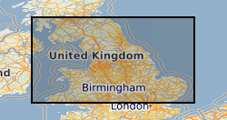
UK [id=139300]
- Date (Creation)
- 1979
- Geographic identifier
-
UKM
- Date (Revision)
- 2009
- Geographic identifier
-
WALES [id=170000]
- Date (Creation)
- 1979
- Geographic identifier
-
WLS
- Date (Revision)
- 2009
))
- Begin date
- 1988
- Supplemental Information
- Dr Brin Roberts and Steve Hirons, Department of Geology, Birkbeck College, University of London WC1E 7HX. When complete will cover all Lower Palaeozoic terranes in UK including borehole data for the concealed Caledonides of Eastern England. Samples 1 per 1-2 square km, grid references to 10 m precision. Oracle table BGS.PELITE. A working copy is kept on the SAN, and is being updated intermittentley. This will be uploaded to the Oracle master copy annually.
- Unique resource identifier
- OSGB 1936 / British National Grid (EPSG::27700)
- Distribution format
-
-
ORACLE - Oracle print out.
(
witheld
)
-
Microsoft Excel
(
witheld
)
-
ORACLE - Oracle print out.
(
witheld
)
0115 936 3276
- OnLine resource
-
BGS Homepage
(
WWW:LINK-1.0-http--link
)
The BGS Homepage is an entry point to the BGS data services.
- Hierarchy level
- dataset Dataset
- Other
- dataset
Conformance result
- Date (Publication)
- 2011
- Explanation
- See the referenced specification
- Pass
- No
Conformance result
- Date (Publication)
- 2010-12-08
- Explanation
- See http://eur-lex.europa.eu/LexUriServ/LexUriServ.do?uri=OJ:L:2010:323:0011:0102:EN:PDF
- Pass
- No
- Statement
- ORACLE table holding sample numbers, locations (UK National Grid) and illite crystallinity values measured for pelitic (mudrock) samples from Lower Palaeozoic terranes in the UK.
- File identifier
- 9df8df51-62ee-37a8-e044-0003ba9b0d98 XML
- Metadata language
- EnglishEnglish
- Hierarchy level
- dataset Dataset
- Date stamp
- 2026-05-06
- Metadata standard name
- UK GEMINI
- Metadata standard version
- 2.3
- Dataset URI
- http://data.bgs.ac.uk/id/dataHolding/13480157
Overviews
Spatial extent
Provided by
