 NERC Data Catalogue Service
The BGS Lexicon of Named Rock Units (April 2019)
Simple
- Date (Creation)
- 2019-04-30
0115 936 3276
0115 936 3276
- Maintenance and update frequency
- notPlanned Not planned
- GEMET - INSPIRE themes, version 1.0
- BGS Thesaurus of Geosciences
-
- Stratigraphic nomenclature
- Lithologic unit
- Rock stratigraphic unit
- dataCentre
- Keywords
-
- NERC_DDC
- Access constraints
- otherRestrictions Other restrictions
- Other constraints
- no limitations
- Other constraints
- The dataset is made freely available for access, e.g. via the Internet. Either no third party data / information is contained in the dataset or BGS has secured written permission from the owner(s) of any third party data / information contained in the dataset to make the dataset freely accessible.
- Use constraints
- otherRestrictions Other restrictions
- Other constraints
- The copyright of materials derived from the British Geological Survey's work is vested in the Natural Environment Research Council [NERC]. No part of this work may be reproduced or transmitted in any form or by any means, or stored in a retrieval system of any nature, without the prior permission of the copyright holder, via the BGS Intellectual Property Rights Manager. Use by customers of information provided by the BGS, is at the customer's own risk. In view of the disparate sources of information at BGS's disposal, including such material donated to BGS, that BGS accepts in good faith as being accurate, the Natural Environment Research Council (NERC) gives no warranty, expressed or implied, as to the quality or accuracy of the information supplied, or to the information's suitability for any use. NERC/BGS accepts no liability whatever in respect of loss, damage, injury or other occurence however caused.
- Other constraints
- Available under the Open Government Licence subject to the following acknowledgement accompanying the reproduced NERC materials "Contains NERC materials ©NERC [year]"
- Metadata language
- EnglishEnglish
- Topic category
-
- Geoscientific information
- Geographic identifier
-
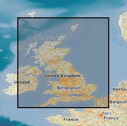
GB
- Date (Revision)
- 2009
- Geographic identifier
-
UK CONTINENTAL SHELF [id=121701]
- Date (Creation)
- 1979
- Geographic identifier
-
UK [id=139300]
- Date (Creation)
- 1979
- Geographic identifier
-
UKM
- Date (Revision)
- 2009
))
- Begin date
- 1786
- End date
- 2019-04-30
- Supplemental Information
- Includes information imported from earlier databases. The data have been continuously refined and developed to reflect current state of knowledge. The data are incomplete as they are constantly being refined, a flagging system indicates the completeness of individual entries.
- Unique resource identifier
- OSGB 1936 / British National Grid (EPSG::27700)
- Unique resource identifier
- TM65 / Irish Grid (EPSG::29902)
- Unique resource identifier
- WGS 84 (EPSG::4326)
- Distribution format
-
0115 936 3276
- OnLine resource
-
The BGS Lexicon of Named Rock Units (April 2019)
(
WWW:DOWNLOAD-1.0-http--download
)
The Lexicon of Named Rock Units provides definitions of lithostratigraphic, lithodemic, and litho-morpho-genetic geological units of the United Kingdom and its associated continental shelf. The Lexicon focuses mainly on units of Member, Formation, Group and higher rank (and equivalents) but it also includes information on some units of lesser rank, notably economically important coal seams and laterally extensive marine bands. It includes superficial and bedrock units. It includes synonyms and other names not currently recognised by the BGS or regarded as obsolete. Full Lexicon entries include geological unit name, a persistent unique identifier, map code, currency, rank, parent unit and rank, age, lithology, definitions of boundaries, thickness, previous and alternative names, geographical extent, type localities, and bibliographical references.
- Hierarchy level
- dataset Dataset
- Other
- dataset
Conformance result
- Date (Publication)
- 2011
- Explanation
- See the referenced specification
- Pass
- No
Conformance result
- Date (Publication)
- 2010-12-08
- Explanation
- See http://eur-lex.europa.eu/LexUriServ/LexUriServ.do?uri=OJ:L:2010:323:0011:0102:EN:PDF
- Pass
- No
- Statement
- Includes information imported from earlier databases. Formal records have good lineage and can be traced back to original signed paper records completed by BGS mapping geologists and can be verified by Lexicon Manager.
- File identifier
- 88fce25b-dd5e-3a4a-e054-002128a47908 XML
- Metadata language
- EnglishEnglish
- Hierarchy level
- dataset Dataset
- Date stamp
- 2026-04-30
- Metadata standard name
- UK GEMINI
- Metadata standard version
- 2.3
- Dataset URI
- http://data.bgs.ac.uk/id/dataHolding/13607461
Overviews
Spatial extent
Provided by
