
Near-field TLS datasets from the 2016 central Italian Earthquake Sequence covering the 30th Oct Norcia Earthquake (NERC grant NE/P018858/1)
Terrestrial laser scanning datasets (including GPS data for georeferencing), and field photographs collected during the 2016 Central Italian Earthquake sequence. Data were collected from multiple localities to capture the co- seismic near-fault deformation along the earthquake surface ruptures from the 30th Oct Norcia Earthquake. See the scan_data.xlsx for individual details of each laser scan location, and readme.txt for a complete description. In each scan site folder you can find the unprocessed raw files and processed ascii files. Field photographs taken at the site and in the aftermath of the 2016 Norcia Earthquake (30th October 2016, Mw6.6) are provided. Relevant references are: Wilkinson, MW, KJW McCaffrey, RR Jones, GP Roberts, RE Holdsworth, LC Gregory, RJ Walters, LNJ Wedmore, H Goodall, F Iezzi (2017). Near-field fault slip of the 2016 Vettore Mw 6.6 earthquake (Central Italy) measured using low-cost GNSS. Scientific Reports 7: 4612. Walters, RJ, LC Gregory, LNJ Wedmore, TJ Craig, K McCaffrey, M Wilkinson, J Chen, Z Li, JR Elliott, H Goodall, F Iezzi, F Livio, AM Michetti, G Roberts, E Vittori (2018). Dual control of fault intersections on stop-start rupture in the 2016 Central Italy seismic sequence. Earth and Planetary Science Letters 500, 1-14. Wedmore, LNJ, LC Gregory, KJW McCaffrey, H Goodall, RJ Walters (in review). Partitioned off-fault deformation in the 2016 Norcia earthquake captured by differential terrestrial laser scanning. Submitted to Geophysical Research Letters (directly related to this dataset). The dataset will also be available on opentopography.com once the above paper is accepted.
Simple
- Date (Creation)
- 2019-02-05
Point of contact
University of Leeds
-
Laura Gregory
(
School of Earth and Environment
)
Leeds
,
LS2 9JT
,
Principal investigator
University of Leeds
-
Laura Gregory
(
School of Earth and Environment
)
Leeds
,
LS2 9JT
,
- Maintenance and update frequency
- notApplicable notApplicable
- GEMET - INSPIRE themes, version 1.0
- BGS Thesaurus of Geosciences
-
- Earthquakes
- dataCentre
- Keywords
-
- NERC_DDC
- Access constraints
- otherRestrictions Other restrictions
- Other constraints
- no limitations
- Other constraints
- The dataset is made freely available for access, e.g. via the Internet. Either no third party data / information is contained in the dataset or BGS has secured written permission from the owner(s) of any third party data / information contained in the dataset to make the dataset freely accessible.
- Use constraints
- otherRestrictions Other restrictions
- Other constraints
- The copyright of materials derived from the British Geological Survey's work is vested in the Natural Environment Research Council [NERC]. No part of this work may be reproduced or transmitted in any form or by any means, or stored in a retrieval system of any nature, without the prior permission of the copyright holder, via the BGS Intellectual Property Rights Manager. Use by customers of information provided by the BGS, is at the customer's own risk. In view of the disparate sources of information at BGS's disposal, including such material donated to BGS, that BGS accepts in good faith as being accurate, the Natural Environment Research Council (NERC) gives no warranty, expressed or implied, as to the quality or accuracy of the information supplied, or to the information's suitability for any use. NERC/BGS accepts no liability whatever in respect of loss, damage, injury or other occurence however caused.
- Other constraints
- Available under the Open Government Licence subject to the following acknowledgement accompanying the reproduced NERC materials "Contains NERC materials ©NERC [year]"
- Metadata language
- EnglishEnglish
- Topic category
-
- Geoscientific information
- Geographic identifier
-
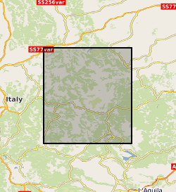
CENTRAL ITALY [id=287500]
- Date (Creation)
- 1979
N
S
E
W
))
- Begin date
- 2016-10-28
- End date
- 2016-11-10
Reference System Information
No information provided.
- Distribution format
-
-
ASCII text
()
-
RiSCAN
(
witheld
)
-
Image (JPEG)
()
-
ASCII text
()
- OnLine resource
- Data ( WWW:DOWNLOAD-1.0-http--download )
- Hierarchy level
- dataset Dataset
- Other
- dataset
Conformance result
- Date (Publication)
- 2011
- Explanation
- See the referenced specification
- Pass
- No
Conformance result
- Date (Publication)
- 2010-12-08
- Explanation
- See http://eur-lex.europa.eu/LexUriServ/LexUriServ.do?uri=OJ:L:2010:323:0011:0102:EN:PDF
- Pass
- No
- Statement
- All data were collected with a Reigl VZ1000 terrestrial laser scanner. All georeferencing was achieved using a differential GPS. Horizontal Coordinates: WGS 84 / UTM zone 33N [EPSG: 32633] Vertical Coordinates: WGS84 Ellipsoid [EPSG: 7030] Unprocessed, raw files, are in Reigl proprietary format. Ascii files are tab delimited and list the X,Y,Z coordinates of the points followed by a laser return intensity value. GPS data files are provided in RINEX format in a separate folder.
- File identifier
- 84977ba1-81fa-06c2-e054-002128a47908 XML
- Metadata language
- EnglishEnglish
- Hierarchy level
- dataset Dataset
- Date stamp
- 2026-03-28
- Metadata standard name
- UK GEMINI
- Metadata standard version
- 2.3
Point of contact
British Geological Survey
Environmental Science Centre,Keyworth
,
NOTTINGHAM
,
NOTTINGHAMSHIRE
,
NG12 5GG
,
United Kingdom
+44 115 936 3100
- Dataset URI
- http://data.bgs.ac.uk/id/dataHolding/13607432
Overviews
Spatial extent
N
S
E
W
Provided by

Associated resources
Not available