 NERC Data Catalogue Service
Gro for GooD project Chloride rainwater results, Kwale County, Kenya (NERC grant NE/M008894/1)
The data sets contain the monthly rainfall volume from manual rain gauge stations spread across the study area. There are 11 rainfall stations. The rain unit is mm. In addition, the dataset contains the chloride concentration in mg/l of the rainfall, for each month. Blank data (-) means data not available due to not enough rain volume, no rainfall or problems when transporting the samples from Kenya to Barcelona. The data available is only from April 2016 to November 2017. This data is useful to calculate the recharge volume by chloride mass balance (CMB) methodology.
https://www.hydrol-earth-syst-sci-discuss.net/11/307/2014/hessd-11-307-2014-print.pdf
Simple
- Date (Creation)
- 2019-01-29
Principal investigator
University of Oxford
-
Dr R A Hope
(
School of Geography and the Environment
)
Oxford
,
OX1 3QY
,
Point of contact
University of Oxford
-
Nancy Gladstone
(
Smith School of Enterprise and the Environment
)
Oxford
,
OX1 3QY
,
- Maintenance and update frequency
- notApplicable notApplicable
- GEMET - INSPIRE themes, version 1.0
- BGS Thesaurus of Geosciences
-
- Ground water recharge
- Chlorides
- Rainfall
- dataCentre
- Keywords
-
- NERC_DDC
- Access constraints
- otherRestrictions Other restrictions
- Other constraints
- no limitations
- Other constraints
- The dataset is made freely available for access, e.g. via the Internet. Either no third party data / information is contained in the dataset or BGS has secured written permission from the owner(s) of any third party data / information contained in the dataset to make the dataset freely accessible.
- Use constraints
- otherRestrictions Other restrictions
- Other constraints
- The copyright of materials derived from the British Geological Survey's work is vested in the Natural Environment Research Council [NERC]. No part of this work may be reproduced or transmitted in any form or by any means, or stored in a retrieval system of any nature, without the prior permission of the copyright holder, via the BGS Intellectual Property Rights Manager. Use by customers of information provided by the BGS, is at the customer's own risk. In view of the disparate sources of information at BGS's disposal, including such material donated to BGS, that BGS accepts in good faith as being accurate, the Natural Environment Research Council (NERC) gives no warranty, expressed or implied, as to the quality or accuracy of the information supplied, or to the information's suitability for any use. NERC/BGS accepts no liability whatever in respect of loss, damage, injury or other occurence however caused.
- Other constraints
- Available under the Open Government Licence subject to the following acknowledgement accompanying the reproduced NERC materials "Contains NERC materials ©NERC [year]"
- Metadata language
- EnglishEnglish
- Topic category
-
- Geoscientific information
- Geographic identifier
-
KE
- Date (Revision)
- 2009
- Geographic identifier
-
KEN
- Date (Revision)
- 2009
- Geographic identifier
-
KENYA [id=687000]
- Date (Creation)
- 1979
N
S
E
W
))
- Begin date
- 2016-04-01
- End date
- 2017-11-30
- Unique resource identifier
- Arc 1960 / UTM zone 37S (EPSG::21037)
- Distribution format
-
-
Microsoft Excel
(
witheld
)
-
Microsoft Excel
(
witheld
)
- OnLine resource
- Data ( WWW:DOWNLOAD-1.0-http--download )
- OnLine resource
- http://reshare.ukdataservice.ac.uk/853667/
- Hierarchy level
- dataset Dataset
- Other
- dataset
Conformance result
- Date (Publication)
- 2011
- Explanation
- See the referenced specification
- Pass
- No
Conformance result
- Date (Publication)
- 2010-12-08
- Explanation
- See http://eur-lex.europa.eu/LexUriServ/LexUriServ.do?uri=OJ:L:2010:323:0011:0102:EN:PDF
- Pass
- No
- Statement
- Eleven (11) stations were carefully selected by researchers to adequately cover the study area's upper middle and lower catchment. The rainwater samples for each of the 11 rain gauge stations were collected in 2L and 1L HDPE (High-density polyethylene) bottles with tight lid (to avoid loss through evaporation) by trained and supervised Field Monitors (FM). Samples from each location were combined for each month. Monthly integrated rainwater samples were collected for all stations every end month by Data Technician and brought to the field office located in Msambweni where integrated samples were resampled into three 15ml bottles for each site and month. These were stored at room temperature for transit to the laboratory for chloride analysis. The rain samples were processed by the Catalan Institute of Water Research (ICRA) in Spain, using ionic chromatography.
- File identifier
- 81ecbd27-7f53-5c53-e054-002128a47908 XML
- Metadata language
- EnglishEnglish
- Hierarchy level
- dataset Dataset
- Date stamp
- 2026-05-03
- Metadata standard name
- UK GEMINI
- Metadata standard version
- 2.3
Point of contact
British Geological Survey
Environmental Science Centre,Keyworth
,
NOTTINGHAM
,
NOTTINGHAMSHIRE
,
NG12 5GG
,
United Kingdom
+44 115 936 3100
- Dataset URI
- http://data.bgs.ac.uk/id/dataHolding/13607422
Overviews
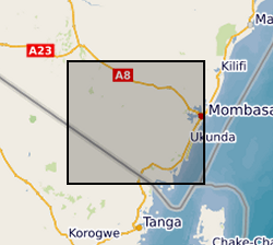
Spatial extent
N
S
E
W
Provided by

Associated resources
Not available