 NERC Data Catalogue Service
Corbetti InSAR Data set (NERC grant NE/L013932/1)
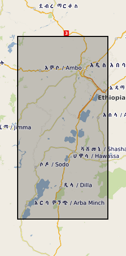
This data set contains a set of 226 unwrapped, geocoded interferograms derived from InSAR scenes processed over Corbetti Volcano, Ethiopia. The data were assembled from multiple sensors and processed using either the ICSE or GAMMA software package. The images presented here are generally not the same size as the raw InSAR images but instead are cropped to the extents of the volcano and its immediate environs.
Simple
- Date (Creation)
- 2018-12-21
Point of contact
University of Bristol
-
Ophelia George
(
Geophysics Laboratory and Field Manager, School of Earth Sciences
)
Wills Memorial Building
,
Bristol
,
BS8 1RJ
,
- Maintenance and update frequency
- notApplicable notApplicable
- GEMET - INSPIRE themes, version 1.0
- BGS Thesaurus of Geosciences
-
- Ground deformation
- Rift valleys
- Geodesy
- dataCentre
- Keywords
-
- NERC_DDC
- Access constraints
- otherRestrictions Other restrictions
- Other constraints
- no limitations
- Other constraints
- The dataset is made freely available for access, e.g. via the Internet. Either no third party data / information is contained in the dataset or BGS has secured written permission from the owner(s) of any third party data / information contained in the dataset to make the dataset freely accessible.
- Use constraints
- otherRestrictions Other restrictions
- Other constraints
- The copyright of materials derived from the British Geological Survey's work is vested in the Natural Environment Research Council [NERC]. No part of this work may be reproduced or transmitted in any form or by any means, or stored in a retrieval system of any nature, without the prior permission of the copyright holder, via the BGS Intellectual Property Rights Manager. Use by customers of information provided by the BGS, is at the customer's own risk. In view of the disparate sources of information at BGS's disposal, including such material donated to BGS, that BGS accepts in good faith as being accurate, the Natural Environment Research Council (NERC) gives no warranty, expressed or implied, as to the quality or accuracy of the information supplied, or to the information's suitability for any use. NERC/BGS accepts no liability whatever in respect of loss, damage, injury or other occurence however caused.
- Other constraints
- Available under the Open Government Licence subject to the following acknowledgement accompanying the reproduced NERC materials "Contains NERC materials ©NERC [year]"
- Metadata language
- EnglishEnglish
- Topic category
-
- Geoscientific information
N
S
E
W
))
- Begin date
- 2003-12-17
- End date
- 2017-01-04
- Unique resource identifier
- WGS 84 (EPSG::4326)
- Distribution format
-
-
ISCE
(
witheld
)
-
XML
(
witheld
)
-
GAMMA
(
witheld
)
-
Text file (TXT)
(
witheld
)
-
ISCE
(
witheld
)
- OnLine resource
- Data ( WWW:DOWNLOAD-1.0-http--download )
- Hierarchy level
- dataset Dataset
- Other
- dataset
Conformance result
- Date (Publication)
- 2011
- Explanation
- See the referenced specification
- Pass
- No
Conformance result
- Date (Publication)
- 2010-12-08
- Explanation
- See http://eur-lex.europa.eu/LexUriServ/LexUriServ.do?uri=OJ:L:2010:323:0011:0102:EN:PDF
- Pass
- No
- Statement
- Please see accompanying README file for full methodology. For each sensor, Pairs of interferograms were selected based on the perpendicular and temporal baselines less than the values provided in Table 1. The topographic phase contribution was removed from all interferograms using a 30 m resolution Shuttle Radar Topography Mission (SRTM) digital elevation model. Following the removal of the topographic phase, the resulting images were filtered and then all pixels with a coherence values above the given threshold were unwrapped and geocoded.
- File identifier
- 7fa754b3-2b73-2063-e054-002128a47908 XML
- Metadata language
- EnglishEnglish
- Hierarchy level
- dataset Dataset
- Date stamp
- 2026-05-06
- Metadata standard name
- UK GEMINI
- Metadata standard version
- 2.3
Point of contact
British Geological Survey
Environmental Science Centre,Keyworth
,
NOTTINGHAM
,
NOTTINGHAMSHIRE
,
NG12 5GG
,
United Kingdom
+44 115 936 3100
- Dataset URI
- http://data.bgs.ac.uk/id/dataHolding/13607410
Overviews
Spatial extent
N
S
E
W
Provided by

Associated resources
Not available