 NERC Data Catalogue Service
UK in-situ stress field orientation from borehole breakouts and drilling induced tensile fractures identified using borehole imaging
Simple
- Date (Creation)
- 2016-03-01
0115 936 3276
0115 936 3276
- Maintenance and update frequency
- notPlanned Not planned
- GEMET - INSPIRE themes, version 1.0
- BGS Thesaurus of Geosciences
-
- Drilling
- Stress field
- Boreholes
- Borehole imaging
- Fractured rock
- Tensile strength
- dataCentre
- Keywords
-
- NERC_DDC
- Access constraints
- otherRestrictions Other restrictions
- Other constraints
- no limitations
- Other constraints
- The dataset is made freely available for access, e.g. via the Internet. Either no third party data / information is contained in the dataset or BGS has secured written permission from the owner(s) of any third party data / information contained in the dataset to make the dataset freely accessible.
- Use constraints
- otherRestrictions Other restrictions
- Other constraints
- The copyright of materials derived from the British Geological Survey's work is vested in the Natural Environment Research Council [NERC]. No part of this work may be reproduced or transmitted in any form or by any means, or stored in a retrieval system of any nature, without the prior permission of the copyright holder, via the BGS Intellectual Property Rights Manager. Use by customers of information provided by the BGS, is at the customer's own risk. In view of the disparate sources of information at BGS's disposal, including such material donated to BGS, that BGS accepts in good faith as being accurate, the Natural Environment Research Council (NERC) gives no warranty, expressed or implied, as to the quality or accuracy of the information supplied, or to the information's suitability for any use. NERC/BGS accepts no liability whatever in respect of loss, damage, injury or other occurence however caused.
- Other constraints
- The dataset is made available to external clients under BGS Digital Data Licence terms and conditions. Revert to the IPR Section (iprdigital@bgs.ac.uk ) if further advice is required with regard to permitted usage.
- Metadata language
- EnglishEnglish
- Topic category
-
- Geoscientific information
- Geographic identifier
-
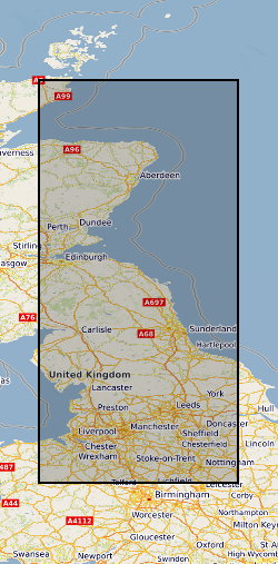
CENTRAL ENGLAND [id=157000]
- Date (Creation)
- 1979
- Geographic identifier
-
NORTHERN ENGLAND [id=151000]
- Date (Creation)
- 1979
- Geographic identifier
-
SCOTLAND [id=140000]
- Date (Creation)
- 1979
- Geographic identifier
-
SCT
- Date (Revision)
- 2009
))
- Begin date
- 2015-01-04
- End date
- 2015-07-07
- Unique resource identifier
- OSGB 1936 / British National Grid (EPSG::27700)
- Distribution format
-
0115 936 3276
- OnLine resource
-
Use of borehole imaging to improve understanding of the in-situ stress orientation of Central and Northern England and its implications for unconventional hydrocarbon resources
(
WWW:LINK-1.0-http--related
)
Andrew Kingdon, Mark W. Fellgett, John D.O. Williams, Use of borehole imaging to improve understanding of the in-situ stress orientation of Central and Northern England and its implications for unconventional hydrocarbon resources, Marine and Petroleum Geology, Volume 73, 2016, Pages 1-20, ISSN 0264-8172, https://doi.org/10.1016/j.marpetgeo.2016.02.012. (https://www.sciencedirect.com/science/article/pii/S0264817216300344)
- OnLine resource
-
Citation Information - Digital Object Identifier (DOI)
(
WWW:LINK-1.0-http--related
)
British Geological Survey. (2017). UK in-situ stress field orientation from borehole breakouts and drilling induced tensile fractures identified using borehole imaging [Data set]. British Geological Survey. https://doi.org/10.5285/cb9c22d8-53f1-489f-b4d3-5d008d2a7841
- Hierarchy level
- dataset Dataset
- Other
- dataset
Conformance result
- Date (Publication)
- 2011
- Explanation
- See the referenced specification
- Pass
- No
Conformance result
- Date (Publication)
- 2010-12-08
- Explanation
- See http://eur-lex.europa.eu/LexUriServ/LexUriServ.do?uri=OJ:L:2010:323:0011:0102:EN:PDF
- Pass
- No
- Statement
- The images were derived from raw: Las, Lis and Dlis files. They were processed using the Landmark Recall Software. The breakouts and drilling induced tensile fractures were interpreted by Mark Fellgett and Andy Kingdon using the IMAGE DISPLAY module of the RECALL software.
- File identifier
- 4c8fcf89-bcce-0858-e054-002128a47908 XML
- Metadata language
- EnglishEnglish
- Hierarchy level
- dataset Dataset
- Date stamp
- 2026-04-30
- Metadata standard name
- UK GEMINI
- Metadata standard version
- 2.3
- Dataset URI
- http://data.bgs.ac.uk/id/dataHolding/13607137
Overviews
Spatial extent
Provided by
