 NERC Data Catalogue Service
UKCP09 Climate projections and clay shrink-swell susceptibility
Simple
- Date (Creation)
- 2017-02
0115 936 3276
0115 936 3276
0115 936 3276
- Maintenance and update frequency
- asNeeded As needed
- GEMET - INSPIRE themes, version 1.0
- BGS Thesaurus of Geosciences
-
- Natural hazards
- Shrinkage cracks
- Climate change
- UK Location (INSPIRE)
- Rainfall
- Subsidence
- Temperature
- Geohazards
- Precipitation (meteorology)
- Shrink-swell clays
- dataCentre
- Keywords
-
- NERC_DDC
- Access constraints
- otherRestrictions Other restrictions
- Other constraints
- licenceOGL
- Use constraints
- otherRestrictions Other restrictions
- Other constraints
- The copyright of materials derived from the British Geological Survey's work is vested in the Natural Environment Research Council [NERC]. No part of this work may be reproduced or transmitted in any form or by any means, or stored in a retrieval system of any nature, without the prior permission of the copyright holder, via the BGS Intellectual Property Rights Manager. Use by customers of information provided by the BGS, is at the customer's own risk. In view of the disparate sources of information at BGS's disposal, including such material donated to BGS, that BGS accepts in good faith as being accurate, the Natural Environment Research Council (NERC) gives no warranty, expressed or implied, as to the quality or accuracy of the information supplied, or to the information's suitability for any use. NERC/BGS accepts no liability whatever in respect of loss, damage, injury or other occurence however caused.
- Other constraints
- Available under the Open Government Licence subject to the following acknowledgement accompanying the reproduced NERC materials "Contains NERC materials ©NERC [year]"
- Spatial representation type
- vector Vector
- Denominator
- 50000
- Metadata language
- EnglishEnglish
- Topic category
-
- Geoscientific information
- Geographic identifier
-
GBN
- Date (Revision)
- 2009
- Geographic identifier
-
GREAT BRITAIN [id=139600]
- Date (Creation)
- 1979
))
- End date
- 2020
- Unique resource identifier
- OSGB 1936 / British National Grid (EPSG::27700)
- Distribution format
-
0115 936 3276
- OnLine resource
-
GeoClimate UKCP09 and UKCP18
(
WWW:LINK-1.0-http--link
)
The BGS GeoClimate shrink–swell national datasets show potential change in subsidence due to changes in climate. They have been developed by combining long term UK Climate Projection (UKCP) scenarios for rainfall and temperature changes with the geotechnical properties of the ground, to identify areas projected to experience the largest increases in susceptibility to subsidence over the next century.
- OnLine resource
-
GeoIndex Onshore
(
WWW:LINK-1.0-http--link
)
BGS GeoIndex is a web tool for professional users who need to access BGS data as part of their business requirements. The map viewer is free to use and is designed to work on desktop and mobile devices.
- Hierarchy level
- dataset Dataset
- Other
- dataset
Conformance result
- Date (Publication)
- 2011
- Explanation
- See the referenced specification
- Pass
- No
Conformance result
- Date (Publication)
- 2010-12-08
- Explanation
- See http://eur-lex.europa.eu/LexUriServ/LexUriServ.do?uri=OJ:L:2010:323:0011:0102:EN:PDF
- Pass
- No
- Statement
- Following the initial determinations of the CHANGE model, based on the ZOODRM (zoom object-oriented distributed recharge model) and Future Flows 11RCM (Regional Climate Models) data, and the initial assessment of the shrink-swell susceptible areas, based on the GeoSure Shrink-Swell layer, a new GeoClimate rating for shrink-swell susceptibility was devised. This new rating was based on the Modified Plasticity Index (IP') values, from the BGS GeoSure Shrink-Swell layer, combined with the Days in Drought (DiD) values, from the ZOODRM and Future Flows 11RCM data. DiD grids were calculated for three different climatic scenarios for the years 2020, 2030, 2040, 2050 and 2080. Each of these grids was combined with the Shrink-Swell layer to produce a revised Volume Change Potential (VCP) score for the UK. All processing was done within ArcGIS.
- File identifier
- 499457f6-2f81-244e-e054-002128a47908 XML
- Metadata language
- EnglishEnglish
- Hierarchy level
- dataset Dataset
- Date stamp
- 2025-12-15
- Metadata standard name
- UK GEMINI
- Metadata standard version
- 2.3
- Dataset URI
- http://data.bgs.ac.uk/id/dataHolding/13607114
Overviews
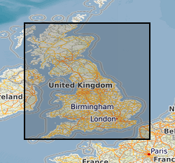
Spatial extent
Provided by
