 NERC Data Catalogue Service
BGS Geology - 50k (DiGMapGB-50) Bedrock version 8
Simple
- Date (Creation)
- 2016
0115 936 3276
0115 936 3276
- Maintenance and update frequency
- notPlanned Not planned
- GEMET - INSPIRE themes, version 1.0
- BGS Thesaurus of Geosciences
-
- EGDI
- Citable Data
- Digital maps
- UK Location (INSPIRE)
- Data
- GIS
- Maps
- Geology
- dataCentre
- Keywords
-
- NERC_DDC
- Access constraints
- otherRestrictions Other restrictions
- Other constraints
- license
- Use constraints
- otherRestrictions Other restrictions
- Other constraints
- The copyright of materials derived from the British Geological Survey's work is vested in the Natural Environment Research Council [NERC]. No part of this work may be reproduced or transmitted in any form or by any means, or stored in a retrieval system of any nature, without the prior permission of the copyright holder, via the BGS Intellectual Property Rights Manager. Use by customers of information provided by the BGS, is at the customer's own risk. In view of the disparate sources of information at BGS's disposal, including such material donated to BGS, that BGS accepts in good faith as being accurate, the Natural Environment Research Council (NERC) gives no warranty, expressed or implied, as to the quality or accuracy of the information supplied, or to the information's suitability for any use. NERC/BGS accepts no liability whatever in respect of loss, damage, injury or other occurence however caused.
- Other constraints
- The dataset is made available to external clients under BGS Digital Data Licence terms and conditions. Revert to the IPR Section (iprdigital@bgs.ac.uk ) if further advice is required with regard to permitted usage.
- Spatial representation type
- vector Vector
- Denominator
- 50000
- Metadata language
- EnglishEnglish
- Topic category
-
- Geoscientific information
- Geographic identifier
-
GBN
- Date (Revision)
- 2009
- Geographic identifier
-
GREAT BRITAIN [id=139600]
- Date (Creation)
- 1979
))
- End date
- 2016 Before
- Unique resource identifier
- OSGB 1936 / British National Grid (EPSG::27700)
- Distribution format
-
-
MapInfo (TAB)
(
witheld
)
-
ESRI Shapefile
(
1994
)
-
Other vector formats are available on request
(
witheld
)
-
MapInfo (TAB)
(
witheld
)
0115 936 3276
- OnLine resource
-
Citation Information - Digital Object Identifier (DOI)
(
WWW:LINK-1.0-http--related
)
BGS Geology - 50k (DiGMapGB-50) Bedrock version 8 British Geological Survey 2016
- OnLine resource
-
BGS Geology: onshore digital geological map of Great Britain data
(
WWW:LINK-1.0-http--link
)
The BGS Geology datasets are digital geological maps of Great Britain based on the different series of published BGS geological maps.
- Hierarchy level
- dataset Dataset
- Other
- dataset
Conformance result
- Date (Publication)
- 2011
- Explanation
- See the referenced specification
- Pass
- No
Conformance result
- Date (Publication)
- 2010-12-08
- Explanation
- See http://eur-lex.europa.eu/LexUriServ/LexUriServ.do?uri=OJ:L:2010:323:0011:0102:EN:PDF
- Pass
- No
- Statement
- The BGS Geology 50k dataset is a digital representation of the geology of Great Britain at 1: 50 000 scale (or 1:63 360 scale for areas surveyed and published prior to 1970). It is a compilation of digital tiles derived from previously published and unpublished maps, archive information and results of field mapping campaigns. The mapping, description and classification of rocks are based upon the interpretations and evidence available at the time of survey, or time of re-evaluation for modifications/correction. The data has been digitally captured from paper record, originally using Bentley MicroStation and latterly ESRI ArcGIS software. Post capture processing has occurred to combine geometry and attribution from existing BGS data resources. Quality control checks are run on individual data batches prior and subsequent to their integration into the main data mosaic. The source dataset is dynamic in nature with periodic comprehensive data releases.
- File identifier
- 3e066dff-80a3-4bf1-e054-002128a47908 XML
- Metadata language
- EnglishEnglish
- Hierarchy level
- dataset Dataset
- Date stamp
- 2025-12-15
- Metadata standard name
- UK GEMINI
- Metadata standard version
- 2.3
- Dataset URI
- http://data.bgs.ac.uk/id/dataHolding/13607012
Overviews
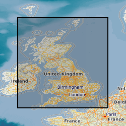
Spatial extent
Provided by
