 NERC Data Catalogue Service
Scanning Electron Microscope (SEM) data from samples collected from sites of lithified artifical ground (Warton, Glengarnock, Derwent Howe, Harrington, Auchendinny, Lynemouth) in Scotland and northwest England (2022-2023) (NERC Grant NE/X009718/1)
This dataset contains SEM data comprising raw data files (.dat) and AZtec file (.oip) for reading the data. The data was collected in 2022-2023. The data was collected for the purpose of visualising spatial textures and microstructures in the collected samples. The data was collected by John MacDonald, Connor Brolly and Robin Hilderman (University of Glasgow) who retain the original data.
Simple
- Date (Creation)
- 2023-12-12
- Maintenance and update frequency
- notApplicable notApplicable
- GEMET - INSPIRE themes, version 1.0
- BGS Thesaurus of Geosciences
-
- Lithification
- dataCentre
- Keywords
-
- NERC_DDC
- Access constraints
- otherRestrictions Other restrictions
- Other constraints
- restricted
- Use constraints
- otherRestrictions Other restrictions
- Other constraints
- The copyright of materials derived from the British Geological Survey's work is vested in the Natural Environment Research Council [NERC]. No part of this work may be reproduced or transmitted in any form or by any means, or stored in a retrieval system of any nature, without the prior permission of the copyright holder, via the BGS Intellectual Property Rights Manager. Use by customers of information provided by the BGS, is at the customer's own risk. In view of the disparate sources of information at BGS's disposal, including such material donated to BGS, that BGS accepts in good faith as being accurate, the Natural Environment Research Council (NERC) gives no warranty, expressed or implied, as to the quality or accuracy of the information supplied, or to the information's suitability for any use. NERC/BGS accepts no liability whatever in respect of loss, damage, injury or other occurence however caused.
- Other constraints
- Either: (i) the dataset is made freely available, e.g. via the Internet, for a restricted category of use (e.g. educational use only); or (ii) the dataset has not been formally approved by BGS for access and use by external clients under licence, but its use may be permitted under alternative formal arrangements; or (iii) the dataset contains 3rd party data or information obtained by BGS under terms and conditions that must be consulted in order to determine the permitted usage of the dataset. Refer to the BGS staff member responsible for the creation of the dataset if further advice is required. He / she should be familiar with the composition of the dataset, particularly with regard to 3rd party IPR contained in it, and any resultant use restrictions. This staff member should revert to the IPR Section (ipr@bgs.ac.uk ) for advice, should the position not be clear.
- Spatial representation type
- grid Grid
- Metadata language
- EnglishEnglish
- Topic category
-
- Geoscientific information
- Geographic identifier
-
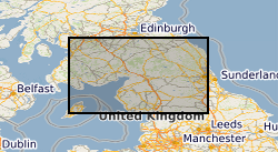
Glengarnock [id=1300131]
- Date (Revision)
- 2002
N
S
E
W
))
- Begin date
- 2022-11-01
- End date
- 2023-10-31
- Unique resource identifier
- WGS 84 (EPSG::4326)
- Distribution format
-
-
Image (TIFF)
()
-
Image (PNG)
()
-
AZtec (OIP)
()
-
Microsoft Word (DOC)
()
-
DAT
()
-
Image (TIFF)
()
- OnLine resource
- Data ( WWW:DOWNLOAD-1.0-http--download )
- Hierarchy level
- dataset Dataset
- Other
- dataset
Conformance result
- Date (Publication)
- 2011
- Explanation
- See the referenced specification
- Pass
- No
Conformance result
- Date (Publication)
- 2010-12-08
- Explanation
- See http://eur-lex.europa.eu/LexUriServ/LexUriServ.do?uri=OJ:L:2010:323:0011:0102:EN:PDF
- Pass
- No
- Statement
- Sample imaging and chemical mapping was conducted on polished thin sections with a ca 20 nm carbon coating using a Zeiss Sigma variable pressure field-emission-gun scanning electron microscope (VP-FEGSEM) equipped with an Oxford Instruments Ultimax 170 mm2 Silicon Drift Detector Energy dispersive detector, based in the geoanalytical electron microscopy and spectroscopy (GEMS) facility at the University of Glasgow. Backscattered electron (BSE) imaging and energy-dispersive X-ray spectroscopy (EDX) were conducted in high vacuum using high current mode and accelerating voltage of 20 kV, working distance of 8.0 mm and aperture of 60 μm. The EDX mapping data were acquired and processed using the Oxford Instrument AZtec software. All EDX maps shown have had the AZtec true map function applied, that removes background and artefacts, and resolves issues with element peak overlaps. The raw data files (.dat files) must not be moved in terms of their location relative to the AZtec file (.oip file). The .dat files cannot themselves be opened, but opening the .oip file (using AZtec software from Oxford Instruments) reads the .dat files.
- File identifier
- 0df81d0c-612d-0f1f-e063-0937940a4b16 XML
- Metadata language
- EnglishEnglish
- Hierarchy level
- dataset Dataset
- Date stamp
- 2026-05-06
- Metadata standard name
- UK GEMINI
- Metadata standard version
- 2.3
Point of contact
British Geological Survey
Environmental Science Centre,Keyworth
,
NOTTINGHAM
,
NOTTINGHAMSHIRE
,
NG12 5GG
,
United Kingdom
+44 115 936 3100
- Dataset URI
- http://data.bgs.ac.uk/id/dataHolding/13608165
Overviews
Spatial extent
N
S
E
W
Provided by

Associated resources
Not available