 NERC Data Catalogue Service
BGS Geology - 10k (DiGMapGB-10) Artificial version 2
Data identifies landscape areas (shown as polygons) attributed with type of artificial or man-made ground. It indicates areas where the ground surface has been significantly modified by human activity. The scale of the data is 1:10 000 scale. Onshore coverage is partial with approximately 30% of England, Scotland and Wales available in the version 2 data release. BGS intend to continue developing coverage at this scale; current focus is to include all large priority urban areas, along with road and rail transport corridors. Types of artificial ground include: Infilled ground areas where original geology has been removed and then wholly or partially back filled includes waste or landfill sites. Landscaped ground areas where surface has been reshaped includes former sand and gravel workings for recreation and amenity use. Made ground man made features including embankments and spoil heaps. Reclaimed ground are areas of land fill, where new ground is created, usually in coastal margins, may be for example a consequence of draining of submerged wetlands and beach rebuilding. Worked ground areas where ground has been removed including quarries and road cuttings. Disturbed ground areas of ill-defined shallow or near surface mineral workings where distinction cannot be made between made and worked ground. Whilst artificial ground may not be considered as part of the 'real geology' of bedrock and superficial deposits it does affect them. Artificial ground impacts on the near surface ground conditions which are important to human activities and economic development. Due to the constantly changing nature of land use and re-use/redevelopment caution must be exercised when using this data as it represents a snapshot in time rather than an evolving picture hence the data may become dated very rapidly. The data are available in vector format (containing the geometry of each feature linked to a database record describing their attributes) as ESRI shapefiles and are available under BGS data licence.
Simple
- Date (Creation)
- 2012
Distributor
British Geological Survey
-
Enquiries
0115 936 3276
Environmental Science Centre, Nicker Hill, Keyworth
,
NOTTINGHAM
,
NOTTINGHAMSHIRE
,
NG12 5GG
,
United Kingdom
0115 936 3143
0115 936 3276
Point of contact
British Geological Survey
-
Enquiries
0115 936 3276
Environmental Science Centre, Nicker Hill, Keyworth
,
NOTTINGHAM
,
NOTTINGHAMSHIRE
,
NG12 5GG
,
United Kingdom
0115 936 3143
0115 936 3276
- Maintenance and update frequency
- notPlanned Not planned
- GEMET - INSPIRE themes, version 1.0
- BGS Thesaurus of Geosciences
-
- Digital maps
- GIS
- Citable Data
- Data
- UK Location (INSPIRE)
- Geology
- Maps
- dataCentre
- Keywords
-
- NERC_DDC
- Access constraints
- otherRestrictions Other restrictions
- Other constraints
- license
- Use constraints
- otherRestrictions Other restrictions
- Other constraints
- The copyright of materials derived from the British Geological Survey's work is vested in the Natural Environment Research Council [NERC]. No part of this work may be reproduced or transmitted in any form or by any means, or stored in a retrieval system of any nature, without the prior permission of the copyright holder, via the BGS Intellectual Property Rights Manager. Use by customers of information provided by the BGS, is at the customer's own risk. In view of the disparate sources of information at BGS's disposal, including such material donated to BGS, that BGS accepts in good faith as being accurate, the Natural Environment Research Council (NERC) gives no warranty, expressed or implied, as to the quality or accuracy of the information supplied, or to the information's suitability for any use. NERC/BGS accepts no liability whatever in respect of loss, damage, injury or other occurence however caused.
- Other constraints
- The dataset is made available to external clients under BGS Digital Data Licence terms and conditions. Revert to the IPR Section (iprdigital@bgs.ac.uk ) if further advice is required with regard to permitted usage.
- Spatial representation type
- vector Vector
- Denominator
- 250000
- Metadata language
- EnglishEnglish
- Topic category
-
- Geoscientific information
- Geographic identifier
-
GBN
- Date (Revision)
- 2009
- Geographic identifier
-
GREAT BRITAIN [id=139600]
- Date (Creation)
- 1979
N
S
E
W
))
- End date
- 2012
- Unique resource identifier
- OSGB 1936 / British National Grid (EPSG::27700)
- Distribution format
-
-
ESRI Shapefile
(
1994
)
-
ESRI Shapefile
(
1994
)
Distributor
British Geological Survey
-
Enquiries
0115 936 3276
Environmental Science Centre, Nicker Hill, Keyworth
,
NOTTINGHAM
,
NOTTINGHAMSHIRE
,
NG12 5GG
,
United Kingdom
0115 936 3143
0115 936 3276
- OnLine resource
- BGS Datasets - BGS Geology 10-25K ( WWW:LINK-1.0-http--link )
- OnLine resource
- BGS Geology: onshore digital geological map of Great Britain data ( WWW:LINK-1.0-http--link )
- OnLine resource
-
Citation Information - Digital Object Identifier (DOI)
(
WWW:LINK-1.0-http--related
)
British Geological Survey. (2013). Digital Geological Map Data of Great Britain - 10k (DiGMapGB-10) Artificial version 2 [Data set]. British Geological Survey. https://doi.org/10.5285/a0a9d1ed-e0ac-45c9-8e14-d773ae9e8840
- Hierarchy level
- dataset Dataset
- Other
- dataset
Conformance result
- Date (Publication)
- 2011
- Explanation
- See the referenced specification
- Pass
- No
Conformance result
- Date (Publication)
- 2010-12-08
- Explanation
- See http://eur-lex.europa.eu/LexUriServ/LexUriServ.do?uri=OJ:L:2010:323:0011:0102:EN:PDF
- Pass
- No
- Statement
- The BGS Geology 10k dataset is a digital representation of the geology of Great Britain at 1: 10 000 scale. It is a compilation of digital tiles derived from previously published and unpublished maps, archive information and results of field mapping campaigns. The mapping, description and classification of rocks are based upon the interpretations and evidence available at the time of survey, or time of re-evaluation for modifications/correction. The data has been digitally captured from paper record, originally using Bentley MicroStation and latterly ESRI ArcGIS software. Post capture processing has occurred to combine geometry and attribution from existing BGS data resources. Quality control checks are run on individual data batches prior and subsequent to their integration into the main data mosaic. The source dataset is dynamic in nature with periodic comprehensive data releases.
- File identifier
- 085bd761-7437-3315-e054-002128a47908 XML
- Metadata language
- EnglishEnglish
- Hierarchy level
- dataset Dataset
- Date stamp
- 2025-12-15
- Metadata standard name
- UK GEMINI
- Metadata standard version
- 2.3
Point of contact
British Geological Survey
Environmental Science Centre,Keyworth
,
NOTTINGHAM
,
NOTTINGHAMSHIRE
,
NG12 5GG
,
United Kingdom
+44 115 936 3100
- Dataset URI
- http://data.bgs.ac.uk/id/dataHolding/13606393
Overviews
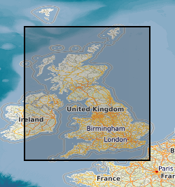
Spatial extent
N
S
E
W
Provided by

Associated resources
Not available