 NERC Data Catalogue Service
Digital Geological Map Data of Great Britain - 25k (DiGMapGB-25) Mass Movement version 2
Data identifying landscape areas (shown as polygons) attributed with geological names. The scale of the data is 1:25 000 scale. Onshore coverage is partial and BGS has no intention to create a national coverage at this scale. Areas covered are essentially special areas of 'classic' geology and include Llandovery (central Wales), Coniston (Lake District) and Cuillan Hills (Isle of Skye). Mass movement describes areas where deposits have moved down slope under gravity to form landslips. These landslips can affect bedrock, superficial or artificial ground. Another batch of tiles was added to the data in 2012 to bring the total to 167 for this version 2 release. Mass movement deposits are described in the BGS Rock Classification Scheme Volume 4. However the data also includes foundered strata, where ground has collapsed due to subsidence (this is not described in the Rock Classification Scheme). Caution should be exercised with this data; whilst mass movement events are recorded in the data due to the dynamic nature of occurrence significant changes may have occurred since the data was released. The data should therefore be regarded as a snapshot in time (as at 2008). The data are available in vector format (containing the geometry of each feature linked to a database record describing their attributes) as ESRI shapefiles and are available under BGS data licence. Another batch of tiles was added to the data in 2012 to bring the total to 167 for this version 2 release.
Simple
- Date (Creation)
- 2012
- Date (Publication)
- 2012
Distributor
British Geological Survey
-
Enquiries
0115 936 3276
Environmental Science Centre, Nicker Hill, Keyworth
,
NOTTINGHAM
,
NOTTINGHAMSHIRE
,
NG12 5GG
,
United Kingdom
0115 936 3143
0115 936 3276
Point of contact
British Geological Survey
-
Enquiries
0115 936 3276
Environmental Science Centre, Nicker Hill, Keyworth
,
NOTTINGHAM
,
NOTTINGHAMSHIRE
,
NG12 5GG
,
United Kingdom
0115 936 3143
0115 936 3276
- Maintenance and update frequency
- notPlanned Not planned
- GEMET - INSPIRE themes, version 1.0
- BGS Thesaurus of Geosciences
-
- UK Location (INSPIRE)
- Citable Data
- Data
- Geology
- GIS
- Maps
- Digital maps
- dataCentre
- Keywords
-
- NERC_DDC
- Access constraints
- otherRestrictions Other restrictions
- Other constraints
- license
- Use constraints
- otherRestrictions Other restrictions
- Other constraints
- The copyright of materials derived from the British Geological Survey's work is vested in the Natural Environment Research Council [NERC]. No part of this work may be reproduced or transmitted in any form or by any means, or stored in a retrieval system of any nature, without the prior permission of the copyright holder, via the BGS Intellectual Property Rights Manager. Use by customers of information provided by the BGS, is at the customer's own risk. In view of the disparate sources of information at BGS's disposal, including such material donated to BGS, that BGS accepts in good faith as being accurate, the Natural Environment Research Council (NERC) gives no warranty, expressed or implied, as to the quality or accuracy of the information supplied, or to the information's suitability for any use. NERC/BGS accepts no liability whatever in respect of loss, damage, injury or other occurence however caused.
- Other constraints
- The dataset is made available to external clients under BGS Digital Data Licence terms and conditions. Revert to the IPR Section (iprdigital@bgs.ac.uk ) if further advice is required with regard to permitted usage.
- Spatial representation type
- vector Vector
- Denominator
- 250000
- Metadata language
- EnglishEnglish
- Topic category
-
- Geoscientific information
- Geographic identifier
-
GBN
- Date (Revision)
- 2009
- Geographic identifier
-
GREAT BRITAIN [id=139600]
- Date (Creation)
- 1979
N
S
E
W
))
- End date
- 2008
- Unique resource identifier
- OSGB 1936 / British National Grid (EPSG::27700)
- Distribution format
-
-
ESRI Shapefile
(
1994
)
-
ESRI Shapefile
(
1994
)
Distributor
British Geological Survey
-
Enquiries
0115 936 3276
Environmental Science Centre, Nicker Hill, Keyworth
,
NOTTINGHAM
,
NOTTINGHAMSHIRE
,
NG12 5GG
,
United Kingdom
0115 936 3143
0115 936 3276
- OnLine resource
- BGS Geology: onshore digital geological map of Great Britain data ( WWW:LINK-1.0-http--link )
- OnLine resource
-
Citation Information - Digital Object Identifier (DOI)
(
WWW:LINK-1.0-http--related
)
British Geological Survey . (2008). Digital Geological Map Data of Great Britain - 25k (DiGMapGB-25) Mass Movement version 2 [Data set]. British Geological Survey. https://doi.org/10.5285/bff65f7e-cbca-4016-82e5-40896fbb637c
- Hierarchy level
- dataset Dataset
- Other
- dataset
Conformance result
- Date (Publication)
- 2011
- Explanation
- See the referenced specification
- Pass
- No
Conformance result
- Date (Publication)
- 2010-12-08
- Explanation
- See http://eur-lex.europa.eu/LexUriServ/LexUriServ.do?uri=OJ:L:2010:323:0011:0102:EN:PDF
- Pass
- No
- Statement
- Each DiGMapGB-25 digital tile is typically based on the latest 1:25 000 scale geological map. These geological maps are compiled on contemporary Ordnance Survey National Grid topographical base maps at 1:25 000 scale. Most are based on more detailed 1:10 000 or 1:10 560 (six-inch to one-mile) scale geological maps, and as a consequence they have not been digitised to create DiGMapGB-25 tiles as the source 1:10 000 or 1:10 560 maps could be used to create DiGMapGB-10 data. There are about 52 tiles of 1:25 000 scale data produced by ‘rapid mapping’ surveys in parts of Central Wales, the Scottish Highlands and the Southern Uplands. These were carried out at 1:25 000 scale rather than the normal 1:10 000 scale in order to expedite completion of the 1:50 000 scale map series. The data has been digitally captured from paper record, originally using Bentley MicroStation and latterly ESRI ArcGIS software. Post capture processing has occurred to combine geometry and attribution from existing BGS data resources. Changes may have been made to the geological interpretation but major revisions to the geological lines have generally been avoided. The geological nomenclature has been reviewed and revised, as far as reasonably possible, to conform to the most up-to-date accepted usage; usually this will also agree with the DiGMapGB-50 dataset. The lithology of bedrock units and superficial deposits recorded for DiGMapGB-25 may differ slightly from those given for the same area in DiGMapGB-50, but they should generally fall within the description used for the DiGMapGB-50 data. 34 The change from Version 1 to Version 2 reflected a major change in the coding of polygons and linear features from attribute level 11 to 18. Another batch of tiles was added to the data in 2012 to bring the total released to 167. The LEX_ROCK codes were replaced by LEX_RCS codes with the lithology based on the hierarchical BGS Rock Classification Scheme. The superseded LEX_ROCK field was retained, to link back to previous versions of DiGMapGB, but demoted in the attribute list.
- File identifier
- 085bd761-7431-3315-e054-002128a47908 XML
- Metadata language
- EnglishEnglish
- Hierarchy level
- dataset Dataset
- Date stamp
- 2025-12-15
- Metadata standard name
- UK GEMINI
- Metadata standard version
- 2.3
Point of contact
British Geological Survey
Environmental Science Centre,Keyworth
,
NOTTINGHAM
,
NOTTINGHAMSHIRE
,
NG12 5GG
,
United Kingdom
+44 115 936 3100
- Dataset URI
- http://data.bgs.ac.uk/id/dataHolding/13606387
Overviews
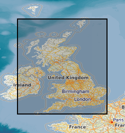
Spatial extent
N
S
E
W
Provided by

Associated resources
Not available