 NERC Data Catalogue Service
Digital Geological Map Data of Great Britain - 50k (DiGMapGB-50) Linear version 7
Simple
- Date (Creation)
- 2013
0115 936 3276
0115 936 3276
0115 936 3276
- Maintenance and update frequency
- notPlanned Not planned
- GEMET - INSPIRE themes, version 1.0
- BGS Thesaurus of Geosciences
-
- Citable Data
- Maps
- UK Location (INSPIRE)
- GIS
- Geology
- Data
- Digital maps
- dataCentre
- Keywords
-
- NERC_DDC
- Access constraints
- otherRestrictions Other restrictions
- Other constraints
- license
- Use constraints
- otherRestrictions Other restrictions
- Other constraints
- The copyright of materials derived from the British Geological Survey's work is vested in the Natural Environment Research Council [NERC]. No part of this work may be reproduced or transmitted in any form or by any means, or stored in a retrieval system of any nature, without the prior permission of the copyright holder, via the BGS Intellectual Property Rights Manager. Use by customers of information provided by the BGS, is at the customer's own risk. In view of the disparate sources of information at BGS's disposal, including such material donated to BGS, that BGS accepts in good faith as being accurate, the Natural Environment Research Council (NERC) gives no warranty, expressed or implied, as to the quality or accuracy of the information supplied, or to the information's suitability for any use. NERC/BGS accepts no liability whatever in respect of loss, damage, injury or other occurence however caused.
- Other constraints
- The dataset is made available to external clients under BGS Digital Data Licence terms and conditions. Revert to the IPR Section (iprdigital@bgs.ac.uk ) if further advice is required with regard to permitted usage.
- Spatial representation type
- vector Vector
- Denominator
- 250000
- Metadata language
- EnglishEnglish
- Topic category
-
- Geoscientific information
- Geographic identifier
-
GBN
- Date (Revision)
- 2009
- Geographic identifier
-
GREAT BRITAIN [id=139600]
- Date (Creation)
- 1979
))
- End date
- 2013
- Unique resource identifier
- OSGB 1936 / British National Grid (EPSG::27700)
- Distribution format
-
-
ESRI Shapefile
(
1994
)
-
ESRI Shapefile
(
1994
)
0115 936 3276
- OnLine resource
-
Citation Information - Digital Object Identifier (DOI)
(
WWW:LINK-1.0-http--related
)
Digital Geological Map Data of Great Britain - 50k (DiGMapGB-50) Bedrock version 7 British Geological Survey 2013
- OnLine resource
-
BGS Geology: onshore digital geological map of Great Britain data
(
WWW:LINK-1.0-http--link
)
The BGS Geology datasets are digital geological maps of Great Britain based on the different series of published BGS geological maps.
- OnLine resource
-
Citation Information - Digital Object Identifier (DOI)
(
WWW:LINK-1.0-http--related
)
British Geological Survey. (2013). Digital Geological Map Data of Great Britain - 50k (DiGMapGB-50) Linear version 7 [Data set]. British Geological Survey. https://doi.org/10.5285/9659E97D-26D8-4805-B74A-44864C93A44F
- Hierarchy level
- dataset Dataset
- Other
- dataset
Conformance result
- Date (Publication)
- 2011
- Explanation
- See the referenced specification
- Pass
- No
Conformance result
- Date (Publication)
- 2010-12-08
- Explanation
- See http://eur-lex.europa.eu/LexUriServ/LexUriServ.do?uri=OJ:L:2010:323:0011:0102:EN:PDF
- Pass
- No
- Statement
- The data shows linear feature polygons, for further lineage information see Digital Geological Map of Great Britain, information notes, 2013, http://www.bgs.ac.uk/downloads/start.cfm?id=644
- File identifier
- 08353f50-44a7-5f48-e054-002128a47908 XML
- Metadata language
- EnglishEnglish
- Hierarchy level
- dataset Dataset
- Date stamp
- 2025-12-15
- Metadata standard name
- UK GEMINI
- Metadata standard version
- 2.3
- Dataset URI
- http://data.bgs.ac.uk/id/dataHolding/13606383
Overviews
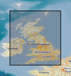
Spatial extent
Provided by
