
Post voyage analyses from Tasman and Coral Seas 2019 (NERC Grant NE/S01067X/1)
These data are derived from a voyage on Australia’s R/V Investigator, IN2019_v04, ‘Hotspot dynamics in the Coral Sea: connections between the Australian plate and the deep Earth’. The voyage surveyed the Tasmantid and Lord Howe Seamounts in the Tasman and Coral Seas, together with the Louisiade Plateau in the Coral Sea, sailing from Cairns on 7 Aug 2019 and arriving in Brisbane on 3 Sep 2019. The voyage summary is available at
https://www.marine.csiro.au/data/reporting/get_file.cfm?eov_pub_id=1443.
This directory includes datasets derived from ship samples and data as part of NERC grant NE/S01067X/1 (e.g., XRF and ICP-MS geochemistry data). Post voyage analyses by Australian collaborators are not included. More details are available in the README file.
Simple
- Date (Creation)
- 2023-07-03
- Maintenance and update frequency
- notApplicable notApplicable
- GEMET - INSPIRE themes, version 1.0
- BGS Thesaurus of Geosciences
-
- Seamounts
- Geochemistry
- X ray fluorescence spectroscopy
- ICP spectroscopy
- Rock samples
- dataCentre
- Keywords
-
- NERC_DDC
- Access constraints
- otherRestrictions Other restrictions
- Other constraints
- restricted
- Use constraints
- otherRestrictions Other restrictions
- Other constraints
- The copyright of materials derived from the British Geological Survey's work is vested in the Natural Environment Research Council [NERC]. No part of this work may be reproduced or transmitted in any form or by any means, or stored in a retrieval system of any nature, without the prior permission of the copyright holder, via the BGS Intellectual Property Rights Manager. Use by customers of information provided by the BGS, is at the customer's own risk. In view of the disparate sources of information at BGS's disposal, including such material donated to BGS, that BGS accepts in good faith as being accurate, the Natural Environment Research Council (NERC) gives no warranty, expressed or implied, as to the quality or accuracy of the information supplied, or to the information's suitability for any use. NERC/BGS accepts no liability whatever in respect of loss, damage, injury or other occurence however caused.
- Other constraints
- Either: (i) the dataset is made freely available, e.g. via the Internet, for a restricted category of use (e.g. educational use only); or (ii) the dataset has not been formally approved by BGS for access and use by external clients under licence, but its use may be permitted under alternative formal arrangements; or (iii) the dataset contains 3rd party data or information obtained by BGS under terms and conditions that must be consulted in order to determine the permitted usage of the dataset. Refer to the BGS staff member responsible for the creation of the dataset if further advice is required. He / she should be familiar with the composition of the dataset, particularly with regard to 3rd party IPR contained in it, and any resultant use restrictions. This staff member should revert to the IPR Section (ipr@bgs.ac.uk ) for advice, should the position not be clear.
- Spatial representation type
- vector Vector
- Metadata language
- EnglishEnglish
- Topic category
-
- Geoscientific information
- Geographic identifier
-
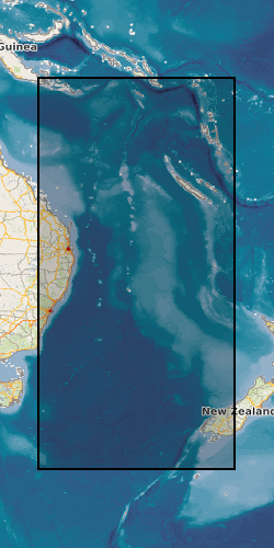
CORAL SEA [id=2001359]
- Date (Revision)
- 2010
- Geographic identifier
-
TASMAN SEA [id=2001476]
- Date (Revision)
- 2010
N
S
E
W
))
- Begin date
- 2019-08-07
- End date
- 2022-06-15
- Unique resource identifier
- WGS 84 (EPSG::4326)
- Distribution format
-
-
Microsoft Excel
(
witheld
)
-
Microsoft Excel
(
witheld
)
- OnLine resource
- Data ( WWW:DOWNLOAD-1.0-http--download )
- Hierarchy level
- dataset Dataset
- Other
- dataset
Conformance result
- Date (Publication)
- 2011
- Explanation
- See the referenced specification
- Pass
- No
Conformance result
- Date (Publication)
- 2010-12-08
- Explanation
- See http://eur-lex.europa.eu/LexUriServ/LexUriServ.do?uri=OJ:L:2010:323:0011:0102:EN:PDF
- Pass
- No
- Statement
- XRF and ICP-MS geochemistry data; full methods details are available in the README file.
- File identifier
- 00d941a0-f265-4273-e063-0937940a51f0 XML
- Metadata language
- EnglishEnglish
- Hierarchy level
- dataset Dataset
- Date stamp
- 2026-04-01
- Metadata standard name
- UK GEMINI
- Metadata standard version
- 2.3
Point of contact
British Geological Survey
Environmental Science Centre,Keyworth
,
NOTTINGHAM
,
NOTTINGHAMSHIRE
,
NG12 5GG
,
United Kingdom
+44 115 936 3100
- Dataset URI
- http://data.bgs.ac.uk/id/dataHolding/13608091
Overviews
Spatial extent
N
S
E
W
Provided by

Associated resources
Not available